Iphone As An Outdoor Device

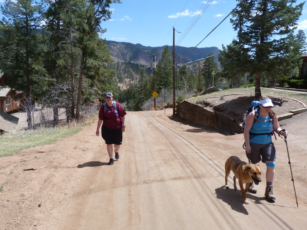
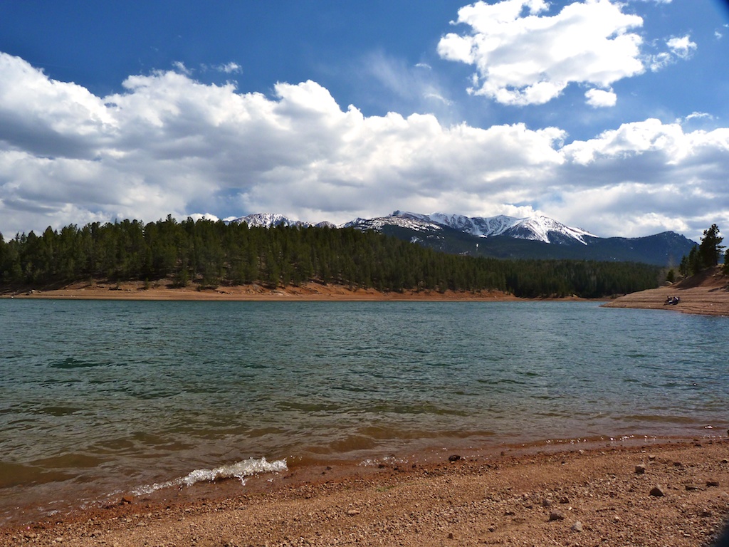
This post is about how I use my iphone 3GS to plan, execute, and record my outdoor adventures.   I am a big fan of the iphone, and have found it to be useful in many areas of my life. Hiking and Backpacking are no exception.   With a few apps the iphone can give you nice topo maps with your GPS location, ability to record your route, save notes and pictures about your trip, and entertain yourself while camping. 

Accessories
For short close to home hikes the ihpone is perfect with out additional hardware. However for multiday trips you may want to consider purchasing a couple of accessories to protect the device and extend its battery life. 

Battery
One of the major limitations of the iphone as an outdoor device is that it doesn’t have a removable battery.   In addition using the “location services” (iphone terminology for gps) can be a real battery drain.   To overcome this limitation you should take some steps to extend your battery life, and consider an external battery charger to replenish your battery on longer outings.   External batteries come in a few different varieties.  I have one that cost $3 plus shipping on amazon, it just plugs into the iphone port and recharges the battery. There are also solar chargers available.  

Even if you are using an external battery you should take some steps to extend your battery life in the field. 

  • If you are going to be out of cell range, go ahead and disable the 3G network through your iPhone settings function. [Settings > General > Network > turn off “3G”]
  • Disable the WiFi network as well. [Settings > General > Network > turn off “WiFi”] 
  • Set your screen brightness as low as possible [Settings > General > Brightness] 
  • Turn off Bluetooth (if you have this enabled)

Waterproof
Another consideration is that the iphone was not designed to be a rugged outdoor device.  In order to protect your investment, and to ensure you can access your maps in the field, you need to protect your device from moisture.   In most cases I think it is sufficient to keep your phone in a ziplock bag.  This does mean you will have to remove to use it, and the bag can easily be torn.  There are several waterproof / rugidaztion covers available for the iphone.  These range from $10 to over $100.   Several of them will allow you to operate the device while it is in the case.  

If you are a real gearhead and want the ultimate outdoor case Magellan makes a rugged waterproof case that will also enhance your gps signal.  However, at more than $100 I am unconvinced this is worth the money. 

Apps

Apps are what make the iphone a powerful outdoor tool.  These are my favorites for use related to hiking / backpacking. 

Accuterra Unlimited
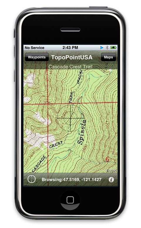
I think the best outdoor app out there is accuterra unlimited.  I have tried a host of GPS apps and this one provides the best maps, and the best features.   For a one time cost you can download high resolution topographic maps for use offline.  This is key when no cell signal is available, and many gps apps don’t provide this.   Accuterra also provides the following key features.
 Import gps tracks from your favorite websites or using wifi.

  •  Record your tracks for viewing and sharing later.  You can save waypoints and pictures to your track as well.
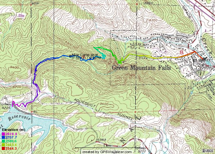
  • Export tracks as kml (google earth) files.  You can then use http://www.gpsvisualizer.com/  to convert these to any common format.   
  • View your current location on a high resolution topo map. 
  •  View points of interest (campgrounds, summits, fishing areas …) on top of the map.

As useful as this app is for navigation, it is electronic, and it is succeptable to failure.  Any prudent outdoorsmen will advise you to always bring along a paper map, and compass, and learn how to use these as a backup. 

NOTE: This app has been sold to another company.  Current users are being asked to register so they can be notified of a new app download.  Not exactly sure what this means for the future of the app.  Hopefully it will be positive  

    Evernote
    Evernote is just a fantastic service for many areas of my life.   It is basically a great way to take notes from any computer or device, and keep them neatly organized in one place.  You can sign up for a free account and download the iphone app from http://www.evernote.com/about/download/iphone/ 

    This is how I use the service to plan and document my adventures. 

    •  I have created a notebook in evernote for keeping my outdoor notes organized.
    •  I keep a running note of day hikes I would like to do with basic information (distance, location, elevation).   When I run across a new hike I add it to this list so I can quickly scan and pick the best option when planning an outing
    •  I keep a separate running note for overnight backpacking trips I would like to do. This has more detailed information I have found about the area.
    •  If I am planning a bigger trip I use the firefox plugin to “clip” information from the web and save it to evernote.  This allows me to collect a note with all of the information about a particular hike.   If you “favorite” this note before you loose signal it will be accessible offline.   It can include pdfs, pictures, trail description….
    •  When I am on the trail I use evernote to record notes.  If I come across a good potential campsite I can snap a picture, type a quick note, or record a voice note about the site.   The app will automatically apply a geotag to the note so I have the exact location of the site.  I can then add a tag “campsite” to the note for easy searching later.  
    •  I also use evernote to keep checklists for my pack both overnite and day packs.  This ensures I am not out on the trail when I realize I forgot my water filter or a jacket. 

    Everytrail
    Everytrail is an app that shares more than just maps.  It provides rich guides that include complete descriptions, and points of interest. The POI’s contain rich media including pictures, video, and audio.  At first blush including audio doesn’t seem like a very big deal.  However, some of the trail guides provide some neat location aware audio tours that really enhance your visit to an area.   The app provides users content in the form of “Guides” and “Trips”.  The guides are moderated, and are a much higher quality than the trips. The app also gives the user the ability to record their trip and use this recording to publish guides / trips to other users.   It comes in a free and paid ($3.99) version.  The free version is basically the same with a few restrictions.  The bigest of which is that you can’t download the maps for offline use. 

    Here is what I like about this app

    • Everytrail provides good tools for createing guides / trips.  This means better quality information for the consumers of these guides & trips.
    • Evertrail incentivizes the creation of guides.  This attracts serious bloggers, and ensures they give good content.
    • The inclusion of audio and Video help bring a trip to life.  
    • The seperation of reviewed guides and trips helps sort out the better content. There is also a raiting system.
    • EveryTrail is owned by tripadvisor which means it is backed by a major company.  I see the potential big things in the future of this product.  

    And what I don’t like

    • There are a lot more trips than guides. Many of these are junk or repeats, so it can be hard to sift through them to find the good ones.  Unfortuantly this is the downside of user driven content and it is found in all apps that follow that model.
    • Topo maps are provided by “open terrain”  I have not used them enough to comment on if they are complete and accurate. 
    • I find the process of downloading maps for use offline confusing.  I should be able to manage it directly from the map page.  Instead you have to turn on the downloading and then “favorite” a trip. 
    • Users have complained about maps disapearing.  Certainly not somthing you want to happen in the back country.  I have not personally experienced this. 

    Geocaching
    Geocaching
    is a real-world, outdoor treasure hunting game using GPS-enabled devices. Participants navigate to a specific set of GPS coordinates and then attempt to find the geocache (container) hidden at that location 

    The iphone app allows you to find geocaches, and download the information needed to find these caches.  It provides some additional fun when you are out on a hike. 

    Peakfinder
    How many times have you gotten to the payoff of a big hike, and as you stand admiring the view you begin wondering what that mounting or hill over there is?   Peakfinder helps you identify what you see on the horizon by giving you a wireframe sketch of the features with labels.  

    Ebook Readers
    There are several good ones available. Ibook, barnes and noble, and kindle.   I like kindle because there is so much good content available for it.

    What ever reader you choose it will allow you do download a book for use offline.   This allows you to have a wealth of reference information such as

    •  Guide books
    •  Survival guides
    •  Wilderness first aid
    •  Mountaineering guide (freedom of the hills) 

    You can also bring along your favorite novel to read as you lounge around camp. Best of all you bring this library with no additional weight added to your pack. 

    There are many more great apps out there for outdoor use.  I don’t use them nearly as often (or not at all) as the ones listed above.  Some of thes include

    •  IBird Explorer
    •  My Nature Animal Tracks
    •  All Trails  – I do use this app it has a lot of content. The quailty of the content is mixed. 
    •   North Face trail head  – this is a user content driven app.   It does have some local trails that are tough to find information on.  But It also has a lot of “bobs walk around the block” and “Joes commute (testing this” 
    • 14er Weather provides convenient links to weather forecasts for 14,000 ft mountains in Colorado.  

    I hope you enjoyed this article.  If you are using a smartphone for outdoor use please share your experience in the comments.   

    Topopointusa-iphone

    Catamount Trail

    The Catamount Reservoirs on Pikes Peak have been among my favorite fishing spots for many years now.  I love them because they are easily accessible, not overcrowded, have the best views of any lake in the area, and are loaded with trout.   The May Saturday we picked to hike the trai, had an outstanding forecast of  80 degrees and Sunny.  Angela and I decided last minute to hike up to the lakes, and take advantage of the weather.  Angela’s knees have been bothering her lately so we weren’t sure we would be able to make this hike happen (You will notice the stylish aqua tape in the pictures).    We are planning to take a back packing trip over Memorial Day, so we decided to take the opportunity to condition our bodies to the extra weight of a full size pack.  We didn’t load them all the way but I had about 25lbs, and Angela about 15.  Our good friend Vanessa decided to join us for the hike as well. 


    Ok so first of all here is the important beta about the trail.

    Length: ~7 mi roudtrip.  Configuration is ‘out and back’
    Elevation Gain:
    ~1600 ft
    Scenery:
    Very good
    Usage:
    Medium
    Trailhead: 
    End of Hondo ave in green mountain falls.  You will need to park and walk up hondo.  Here is a google maps link of the trail head.  
    Notes:
    Great hike.  3 miles of this hike is on the road, which is kind of a bummer.  Trail is steep and rocky in places.   You can drive to the lake so there will be more people there than on the trail. 

     You can access a gps track of the trail here.

    1304883889-10979-174

    We parked just past the Gazebo in Green Mountain falls.  I would highly recommend a stop at the Pantry for breakfast before or after your hike.  They have a lovely patio and delicious food!!    


    The hiking starts with close to a mile of walking up a steep dirt road (Hondo Ave).  I felt like a fool hiking on a road with a 70L pack on my back!!   The signs along Hondo were pretty funny. There is one warning of a dangerous ice flow pedestrian traffic not recommended,  directly above it is a sign that says foot trafic only.  We got a picture with the dangerous ice flow.  In all fairness it looked as if it could have been gnarly in the wintertime. 

    P1020262P1020358P1020357

    At the top of Hondo You will then cross over catamount creek on a nice bridge.  Immediately after the small waterfall look for the Blue Dot trail and sign.  It doesn’t really look like it is a trail but start climbing.  The trail is fairly hard to follow but the more confusing places are marked with a blue dot so just follow those signs.  I read somewhere the orange dots get you to the same place, but require more scrambling.   The blue dot trail climbs pretty steeply along catamount creek.   The steep rocky portion of the trail is probably around 1 mile log.   After about an hour of hiking we crested out of the steep part of the trail.  We decided to stop here and devour the subway sandwiches we brought for lunch.   

    P1020282

    After lunch we continued towards the lakes.  The trail flattened to a much gentler climb for the remainder of the time.  We again picked up catamount creek and followed it the whole way.  The trail crosses a lovely meadow area known as “Garden of Eden” this is supposed to have nice wild flowers in the spring.   This area would make a great campsite, however, I don’t know about the legalities of camping here.  I saw no signs of camp so either people have been great at LNT or camping is prohibited.  After another mile or so we hit a road.  You want to stay to the right on the road you will see the dam to south catamount ahead.   You pass a small pump house and then climb up to the damn.  

    We hung and fished for an hour or so.  It was pretty windy so casting wasn’t fun.  I enjoyed kicking back in my butterfly chair.   Nobody was able to catch any fish.  As usual the trip down seemed much quicker.  You have to take care on the rocks to make sure you have good footing, and you need to constantly check to make sure you are on the trail. 

    The slog back to the car on the steep dusty road was the least fun part of the hike. My dog trip peirced his ear with a fishing hook on the way back home.  It wasn’t a good look for him, and a pain in the ass to get out.  

    Overall this is a good hike for scenery and interesting parts of the trail.  It would be excellent except for the road walk on both ends. 

    P1020350P1020261P1020273P1020279P1020276P1020274P1020278P1020298P1020347P1020290P1020295P1020288P1020283P1020285P1020343P1020315P1020311P1020346P1020306P1020287P1020362

    Flying in a Gobosh

    This isn’t exactly on the main topic of this blog [hiking and camping], but it certainly qualifies as a Colorado Adventure.  This Tuesday I was able to take a “Discovery Flight” with Skyraider aviation out of Centennial Airport (APA) in South Denver.  My wonderful wife got me the lesson for our 5th anniversary this January.   Skyraider specializes in what is known as Light Sport Aircraft.  Sport Pilots and LSA are a fairly new designation with the FAA.  The basic point behind them is to allow people to get into aviation at a much lower cost than was previously available.   At Centennial, Skyraider has two Gobosh 700 planes, as well as a Remos G-3. I got to fly in the Gobosh 700, which is a really cool airplane (see video below).  It has a  “Glass Cockpit” (which means digital instrumentation).  The pilot uses a stick to control the plane instead of the more common yoke.   All of this combined with the easy flight characteristics and great maneuverability makes the gobosh really fun to fly.

    My flight instructor was a guy named Erik Skjerseth, he seemed very knowledgeable and was easy to learn from.   The flight started with a preflight briefing and the standard preflight checks to make sure the plane was ready to fly.  We then pulled the plane out of the hanger (using a little hand truck), and climbed up and into the plane.  Although I have flown a couple of times before this was the first time I got to climb into the “left seat” so that in and of it self was exciting.  Once in the cockpit we turned on the main switches and started the plane.  I taxied to the run-up area. The gobosh doesn’t have a steerable nose wheel so you have to steer using your rudder pedals / brakes this took some getting used to so I swerved around a bit.  I was concentrating on steering and let the plane get going a little fast.  Erik had to tell me to back off the throttle before I set a land speed record. While we sat in the run-up area we revved the engine up to 4500RPM and completed our pre takeoff checklist. 


    After clearing 338 Mike Foxtrot (our tail number) for takeoff we pulled onto the runway and lined up for takeoff.  With my heart beginning to pound a little, I pushed the throttle all the way in, and tried to keep the plane as straight as possible.  We quickly hit 40 kts and Erik instructed me to ‘rotate’ the plane for take off.  I put a little back pressure on the stick, and we were off the ground.  I think Erik was quietly helping me with a little right rudder because the plane didn’t pull to the left nearly as much as it does in the simulator.    I was a little steep on my angle of attack after take off so I had to back off the elevators a little and let us build some airspeed for climbing.   Once in the air I settled down a bit and began to really enjoy the flight.   We spotted parker road ahead and took a right turn to the southeast to follow it.   

    We headed down over the Pinary towards Franktown to practice some maneuvers.  This was great because I live between Franktown and Castle Rock so getting to see the area from 2000 ft AGL was really fun.   We spent 40 minutes or so doing turns, climbs, and descents over Castlewood and Mitchell canyons.  I felt pretty comfortable maneuvering the aircraft, and had a lot of fun flying it around.  For some reason I had a tendency to climb so Erik had to keep asking me to descend.  We had to stay under 8500 feet because there is class B airspace above that.   The instructor complemented me on my handling of the plane, however,  I think he was stroking my ego because I wasn’t really very precise with my maneuvers. In any case the conditions were outstanding and I was having a great time so I took the complement. 


    All to soon it was time to head back up Parker road and begin our decent into APA.  As I made the turn to the north I got one last look at the sun setting behind Pikes Peak what a view!! When we came over the KOA antenna I hit a little bit of turbulence, and the little plane really bounced around.  In the turbulence I got a little close to the antenna and got a warning from the instructor and the garmen.   We got cleared for a straight in approach, and Erik said I could go ahead and land the plane.  My adrenaline definitely went up a notch as I pointed the noise towards the airport and began my final decent.   Everything happened really fast as we made the approach.  I pulled the lever to put the flaps to 15 and then 40 and pulled back on the throttle to slow the plane.  I really didn’t get the plane lined up well early enough so that was a bit stressful. The instructor was very calm and reassuring so I mostly kept my cool.    As we came in I again hit a little turbulence, which startled me, and I over corrected with the stick.   I got the plane lined up and after a bit of a bumpy touch down we were on the ground safe.  While I was happy I got to land the plane I was disappointed it wasn’t a smoother landing.  I had made a bunch of pretty good landings in the simulator and thought I would do better in the real thing.  Man things really happen fast when you are coming in for that landing.  


    After pushing the plane back into the hanger for the night I sat and talked with the instructor for a little bit about what the next steps would be in getting my Sport Pilot Certificate.   Then, after checking my passport (thanks Osama), he took the virginity of my new blue ASA logbook.  I  headed to meet Angela at the “Perfect Landing”.  There we enjoyed a great dinner watching planes take off and land while I excitedly babbled about my experience. 


    Now I can’t stop thinking about it, and I really want to get up and fly again!! 


    P102025410795758-garmins-g3x-glass-panelP1020255P1020253


    Here is a video of one of the Skyraider Instructors flying one of their two Gobosh 700 planes.