Biking Mount Evans

I summited the 14,264′ Mt. Evans a couple of summers ago via an easy route (over mt Spalding from Summit Lake). At that time we were with some inexperienced hikers, and  I wanted to give them an easy day.  I really enjoyed this mountain, and have been longing to return here and summit via my road bike.

Continue reading

Mt Massive

I somehow managed to convince Angela to climb Mt Massive with me to celebrate her 32nd birthday.  We were already in the area doing some mountain biking from one of the 10th Mountain Division Huts near Tennessee Pass.  You can read about that part of our trip here.  We were climbing via the southwest slopes route. This route is accessed via a 4WD road North Halfmoon Creek. Continue reading

La Plata Peak

Route: Northwest Ridge (Standard)
Distance: 9.5 mi round trip
Elevation Gain: 4500 ft
Date Climbed: 6/23/2012

Pre Hike

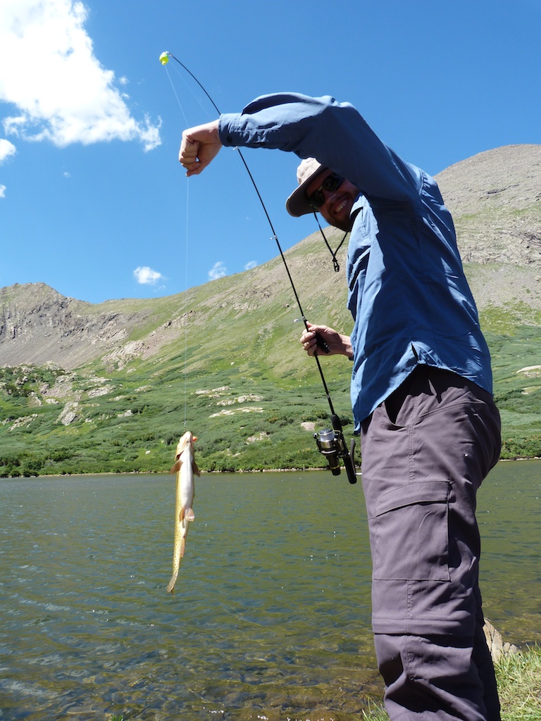
The trailhead for La Plata is three hours from our house in Castle Rock. I happen to be a fan of actually sleeping the night before a climb, so we decided to spend the night in Twin Lakes. We both had Friday off so we enjoyed a pancake breakfast at Snooze, and then headed to Twin Lakes. We spent the day riding our mountain bikes on the Colorado Trail around the lake, and fishing. We then checked into Wolfsden B&B for the evening. We enjoyed a relaxing evening with a great view. Liz and James are great hosts I would highly recommend.

La-plata_28La-plata_25La-plata_31

The Hike
We had a 15 min drive to the trailhead so we slept in until 4:45. We were kind of slow getting going so we didn’t get to the trailhead until 5:45. We took the last parking space at the small parking area off highway 82.
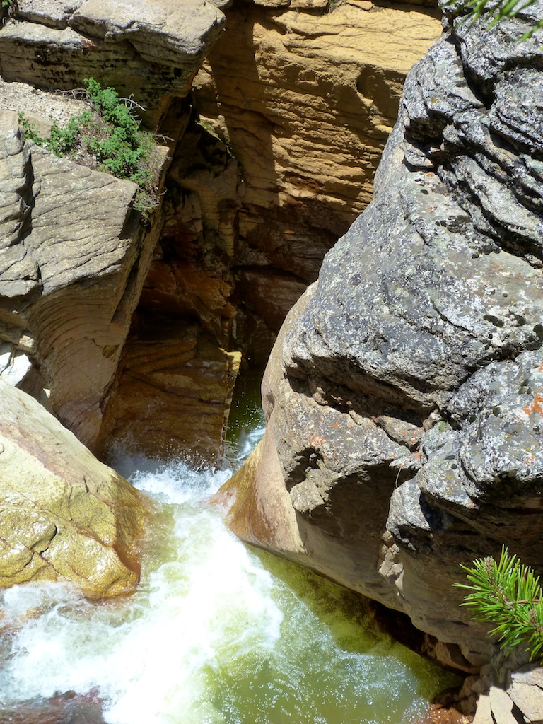
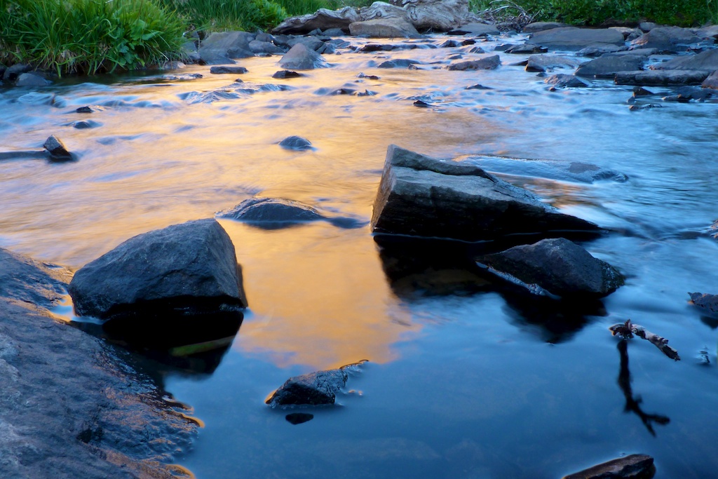
The trail starts off with a couple of creek crossings on good bridges. The second crossing has a really cool waterfall!!

La-plata_2La-plata_23La-plata_22

After crossing the second bridge we accidentally turned left on the small trail instead of following the main trail. To avoid this make sure you continue straight (not left) after crossing the second bridge. We did not realize our error until we reached a creek with no aid for crossing. We checked a map and gps and decided to bushwhack upstream to the main trail. This turned out to be much easier than backtracking I would recommend to anyone who makes the same error. If you simply follow the trail upstream you will reach this crossing.

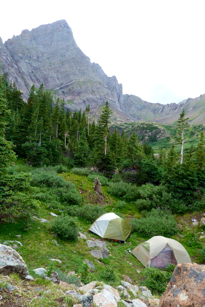
Camping
Last year I was considering doing this trip as an overnight backpack. There was a couple of nice camp sites approximately an hour in. They were directly on the main trail with little privacy. There was no fire rings, so I would not recommend a fire here. Also at the start of the trail there was a warning about not drinking the water in the area. It is contaminated with heavy metals / minerals from mining. I don’t know if the upper creek has this issue, but it would be worth investigating before camping here.

La-plata_17La-plata_20La-plata_18La-plata_19

WIND!!!
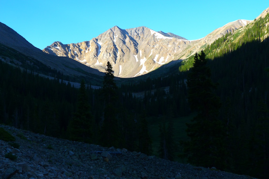
We knew from the forecast that we were likely to encounter bad winds. As we started up the switchbacks around 11500’ the wind really picked up. For me strong wind is super annoying, and it really saps my motivation. It seems there is a point in many climbs where a seed of doubt creeps into your mind (Am I really going to stand on top today?). A couple of parties passed us on the way down, reporting they turned around at the ridgeline due to extreme winds. As we struggled to stand in the gusts I was thinking if I would write a trip report for a failed attempt. It was very annoying, but not yet dangerous so we persevered. By 9AM the wind had subsided to a manageable level.

La-plata_15La-plata_16

Loose Trail
I had read a recent thread on how “loose” the La Plata trail was. I would have to agree that the area between 12K and 13K was exceptionally loose. It was dirt, and small gravel. This caused some wasted effort from slipping backward on the trip up. It was annoying on the return, but didn’t pose much of a hazard. When descending this stuff I find it easiest to not fight gravity. I move pretty quickly and just accept that I am going to slide. It is kind of half plunge stepping half skiing motion, seems to work well for me. It is sort of like sliding on ice. If you bend your knees, keep your center of gravity low, an expect your feet to move in any direction you are fine. I you try to fight it and stop from sliding you are going to have a bad time.

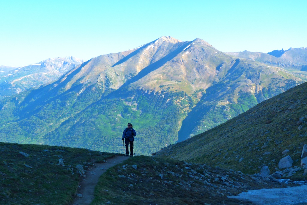
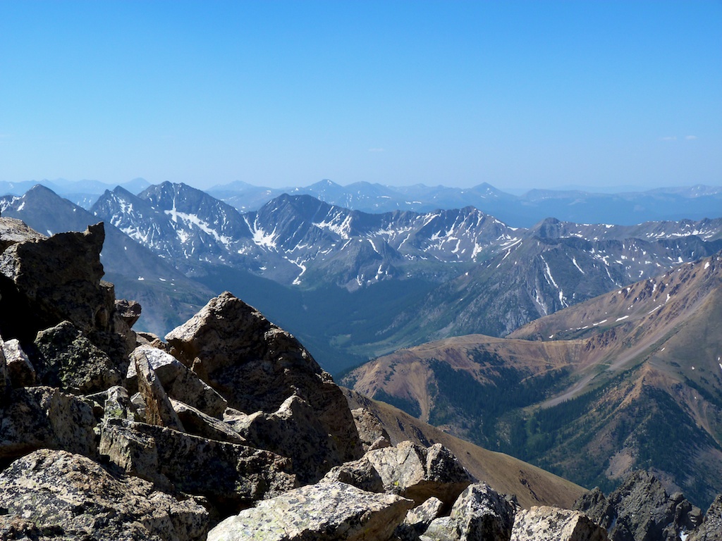
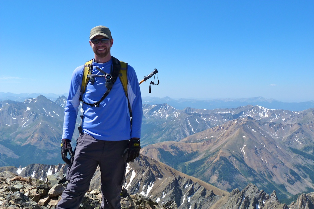
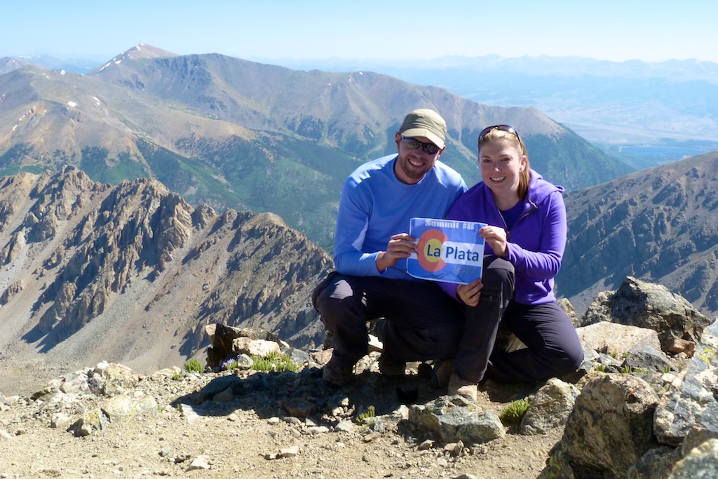
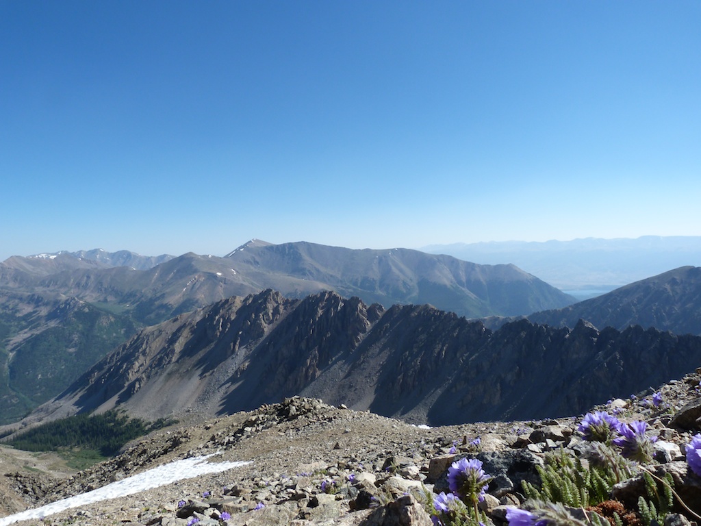
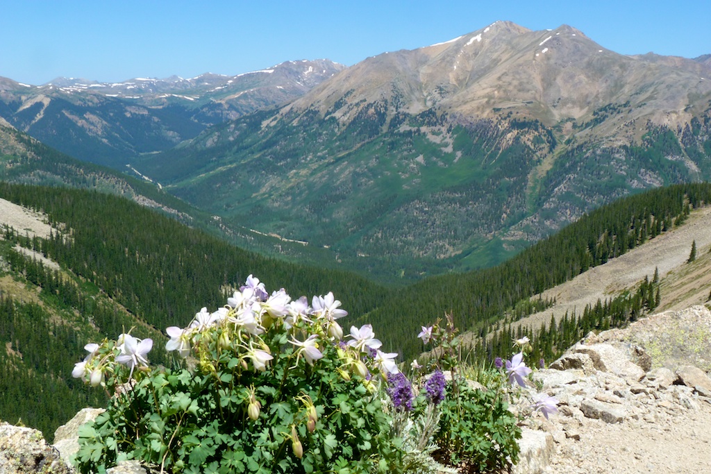
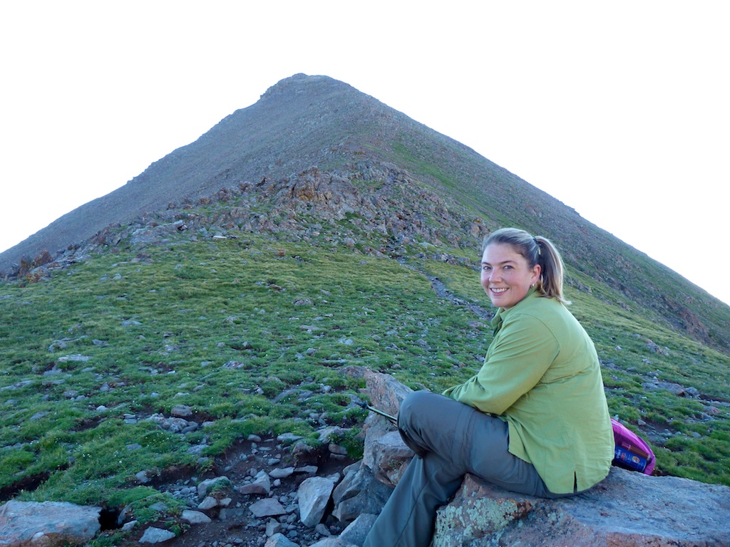
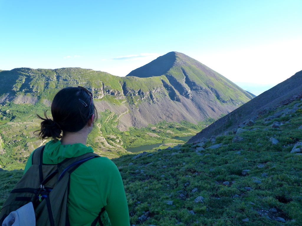
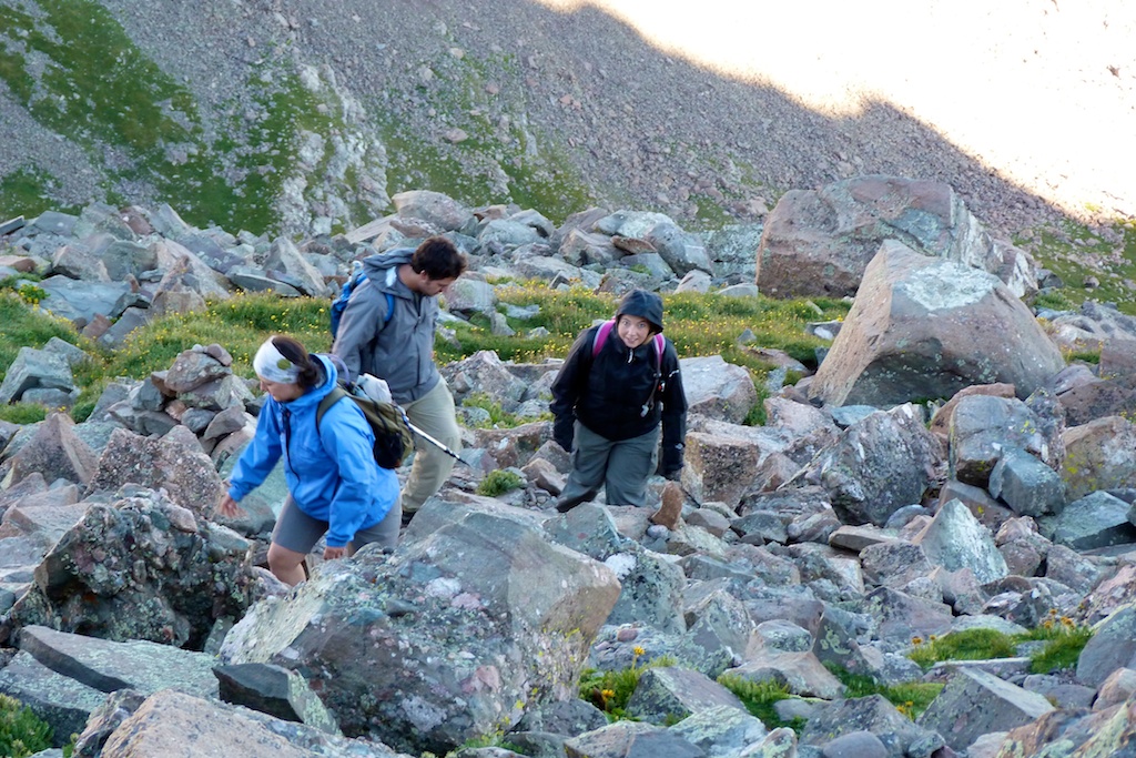
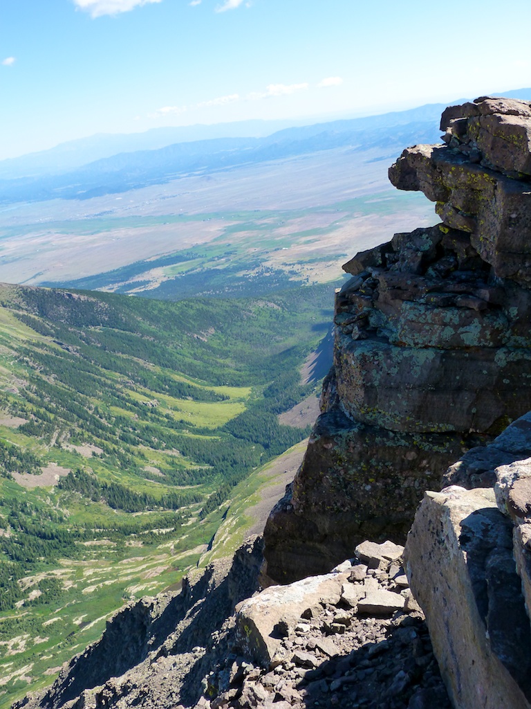
Summit
After 13K the trail fades, and you climb a large heap of talus. I found this section to be a lot of fun. After the talus hopping the trail picks back up, and continues most of the way to the summit. We made the summit at 9:45 (3:45 minutes climbing time). It had turned out to be a beautiful day. There was no sign of incoming storms, and the temperature was pleasant. The well-constructed shelters on the summit provided protection from the remaining wind. We spent 30 minutes enjoying the stunning views. One of the groups sharing the summit was enjoying a sushi lunch.

La-plata_9La-plata_10La-plata_12La-plata_14

Descent
The descent was uneventful, but LONG. I expected to be down in two hours or so, it ended up taking more than three hours to get down. As we lost altitude the temperature rose, at 10,500 it was 85 degrees! I stopped and dipped my shirt, and hat in the stream which provided some welcome relief. My feet were quite sore and tired, which made the last two miles really drag. I wanted nothing more than to be done hiking, I knew the only way to make it stop was to keep putting one foot in front of the other.

La-plata_3La-plata_6La-plata_7La-plata_5

At 1:40 we reached the parking lot. We cranked up the air conditioning, and removed our hiking boots; both felt AMAZING. We met some friends who were camping at Twin Lakes. At the campsite we cooked up some wygyo beef hot dogs ($10 for 4), which were delicious!!

Overall La Plata was a long, beautiful, and fun hike. My favorite so far in the sawatch range.

South Colony Lakes and Humboldt

I elected to spend my 33rd birthday camping in the South Colony lakes area, and climbing the 14er Humboldt. We met up at the lower 2wd trailhead and made the bumpy but uneventful drive to the upper trailhead. The drive took about 20 minutes. We arrived at the upper trailhead around 10AM on Friday morning. We promptly deployed some mothballs (to ward off marmots / porcupines), and readied our packs. The upper trailhead has 3-4 nicely developed campsites. The sites have a flat tent platform and a steel fire ring with grates. There is one site that is maybe .10 of a mile down the trail just across the bridge. There are also at least a half dozen good dispersed sites along South Colony Road. At the trailhead there are no trash or toilet facilities. When we signed in at the register there was a poster saying that they were going to start charging a $20 fee for using the area in the near future so you may want to check the status of that before heading to the trailhead.

The hike up the old 4wd road was pretty easy we took our time and enjoyed the beautiful surroundings. At approximately two miles we hit the “shortcut trail’ that is marked as a pack trail on topo maps. There is a sign here although I think it is a bit misleading. The sign indicates that the trail leads to upper lakes / Humboldt. You can also use this to access the lower lakes and Crestone Needle.
We started seeing campsites somewhere around 3 miles in we decided to keep hiking as we wanted to camp near the upper lakes. We hiked around and surveyed over a dozen good sites before settling on this one. We picked it because it was sheltered / private, yet had good views with access to water. There are a lot of good sites up there however; many of them almost have a campground feel as they are well developed and quite close together.

Campsite
Baby_bighorn

While hunting for a site I ran across a heard of bighorns including a baby. They were scavenging around someone’s campsite.

Big_horn_sheep

We spent the remainder of the afternoon lazing around camp. A couple of thunderstorms blew through in the afternoon. Wow they really move in quickly up there, and the needle blocks your view to the west where they come from. By the time you can see the clouds you have 15 minutes until it is over you.
We turned in early so we could get good nights sleep. Although our camp was hidden from view of other campsites we could hear nearby campers enjoying campfire conversations. At 4:30 AM my slumber was rudely interrupted by the marimba sound emanating from my iphone. As I fumbled around in my tent pocket to snooze it, I could hear the wind blowing hard in the trees above us. We decided we would sleep for another half hour and see if the wind would die down. Reluctantly we extracted ourselves from the warm sleeping bag around 5AM. I went down by the creek and snapped couple of pictures of the Needle as the glow of the pre dawn sun warmed it.   

Crestone_needle_alpenglow

We hit the trail around 6AM. The wind had died down and it looked to be a near perfect day for hiking. I noticed the needle reflecting in the creek below the lower lake. The contrast was to high to get a good picture (this would be a great spot for an alpenglow shot)

Colony_creek

Soon we passed the upper lake and the trail steepened as it began to climb the saddle. As others have noted the CFI has really done nice job improving this trail. I can’t imagine how much work it took to place all those steps. On the way up the ridge we passed some nice wildflowers. They were a couple weeks past prime but still very pretty.

Hiking_up_humbolts_west_ridgeP1030973

We took our time enjoying the view from the trail. We reached the saddle and took a break around 7:20. We got our first views of North Colony lakes here. There was a little wind, but less than I expected.

Angela_with_humboldtSteph_surveys_kit_carson_and_north_colony_lakes

After leaving the ridge the trail gets even steeper and rougher. I stowed my trekking poles as they were just getting in the way at this point. The trail to the false summit soon turns into a fun scramble over a large boulder field. Really the only thing to be careful of here is the occasional loose rock. There are cairns marking a pretty easy route through the boulders, but there are endless options of class two routes. Really you just need to meet up with the ridge line on the other side of the false summit. Angela was somewhat freaked out by the scrambling and so we took quite a bit of time making it up to the ridge.

Picking_our_way_through_boulders

As we reached the home stretch we paused to get some pictures of Humboldt’s impressive north face. A group of four that passed us on the saddle stopped to say hi as they returned from the summit (We had only seen one other group all morning)

Keith_on_humboldt_north_faceP1040079

From the false summit there was a short scramble to the summit. The summit of Humboldt was quite large and had a nice wind shelter. The weather was PERFECT hardly any clouds and dead calm. We shared the summit with a few marmots and pika that came to help celebrate Erik & Steph’s first 14er summit.

P1040086Marmot_below_crestone_peakMarmotPika_on_summitP1040070

The return trip was relatively uneventful. We made good time although it seemed like a longer hike on the way out. We passed 3-4 more groups making their way up the trail

Upon reaching camp we traded in our hiking boots for sandals and headed up to the lake to eat lunch and fish. We enjoyed a lazy afternoon at the lake, and an evening around the campfire.

P1040118Small_cutthroat

There were fewer people camping at the lakes Saturday night.
After a great nights sleep we packed up the tents. As we were packing a few big horn sheep showed up to bid us farewell. Sad that the weekend was already over we waved goodbye to Crestone Needle who had stood guard over our camp. We reluctantly shouldered our packs and forced our aching quads to make the 3.5 mile hike back to the cars.

P1040202Saying_bye_to_crestone_needleSheep_near_camp

This was just a spectacular weekend. It is impossible to even come close to capturing the beauty and grandeur and beauty of this area. I look forward to one day returning to tackle the harder peaks in the group.