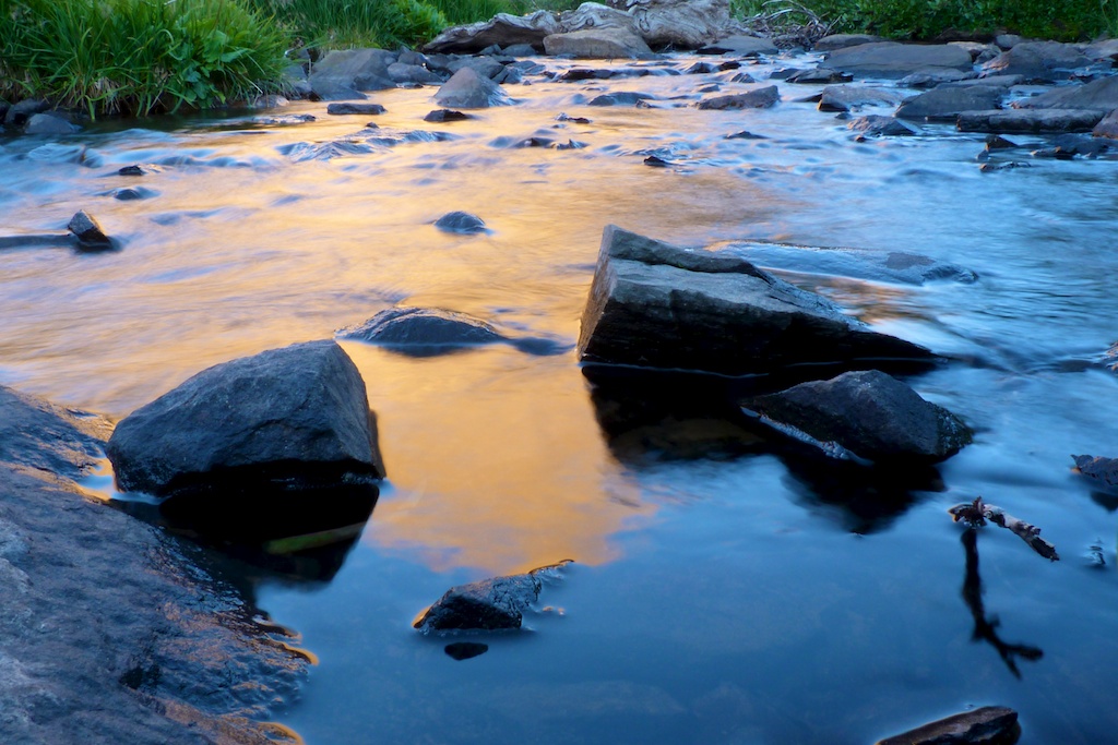
There is Arapahoe Bay Campground near the trailhead, which a good option for staying the night before hiking. The campground was full so we elected to sleep in the back of the truck at the trailhead. There are a few VERY nice backcountry sites along the trail. There are 2-3 sites just above the waterfalls at 4.5 miles. There are 8 sites 7 miles back at Crater Lake.
I believe all back country camping in this area requires permits. June – Sep
Trip Report
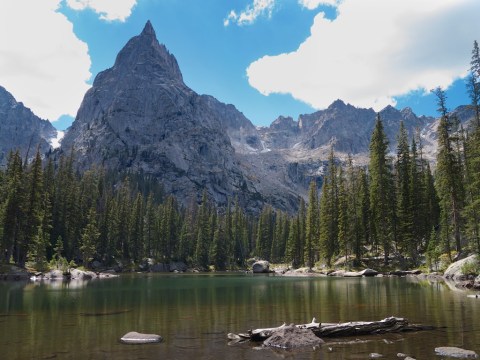
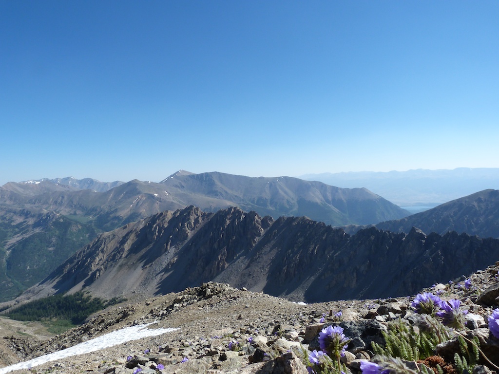
Jeremy, Dayton, and myself have been trying to coordinate schedules ever since our unsuccessful attempt at Juliet Couloir this spring. Jeremy proposed this relatively unknown 12er in the Indian Peaks wilderness. It didn’t take long for Dayton, and I to agree to making Cherokee Peak our objective. Both Gerry Roach and the author of the summit post page, lavish praise on this peak and the Lone Eagle Cirque. This praise is WELL deserved! Continue reading →
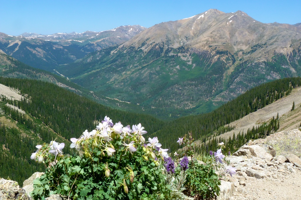
The East Ridge of Pacific Peak is a fun easy scramble on solid rock. The ridge will keep you entertained with a few challenging towers, and plenty of amazing views. At 13,950 Pacific Peak is one of the highest 13ers, and centennial which makes it a worthwhile objective for peak baggers.
I somehow managed to convince Angela to climb Mt Massive with me to celebrate her 32nd birthday. We were already in the area doing some mountain biking from one of the 10th Mountain Division Huts near Tennessee Pass. You can read about that part of our trip here. We were climbing via the southwest slopes route. This route is accessed via a 4WD road North Halfmoon Creek. Continue reading →
Route: Northwest Ridge (Standard) Distance: 9.5 mi round trip Elevation Gain: 4500 ft Date Climbed: 6/23/2012
Pre Hike
The trailhead for La Plata is three hours from our house in Castle Rock. I happen to be a fan of actually sleeping the night before a climb, so we decided to spend the night in Twin Lakes. We both had Friday off so we enjoyed a pancake breakfast at Snooze, and then headed to Twin Lakes. We spent the day riding our mountain bikes on the Colorado Trail around the lake, and fishing. We then checked into Wolfsden B&B for the evening. We enjoyed a relaxing evening with a great view. Liz and James are great hosts I would highly recommend.
The Hike We had a 15 min drive to the trailhead so we slept in until 4:45. We were kind of slow getting going so we didn’t get to the trailhead until 5:45. We took the last parking space at the small parking area off highway 82. The trail starts off with a couple of creek crossings on good bridges. The second crossing has a really cool waterfall!!
After crossing the second bridge we accidentally turned left on the small trail instead of following the main trail. To avoid this make sure you continue straight (not left) after crossing the second bridge. We did not realize our error until we reached a creek with no aid for crossing. We checked a map and gps and decided to bushwhack upstream to the main trail. This turned out to be much easier than backtracking I would recommend to anyone who makes the same error. If you simply follow the trail upstream you will reach this crossing.
Camping Last year I was considering doing this trip as an overnight backpack. There was a couple of nice camp sites approximately an hour in. They were directly on the main trail with little privacy. There was no fire rings, so I would not recommend a fire here. Also at the start of the trail there was a warning about not drinking the water in the area. It is contaminated with heavy metals / minerals from mining. I don’t know if the upper creek has this issue, but it would be worth investigating before camping here.
WIND!!! We knew from the forecast that we were likely to encounter bad winds. As we started up the switchbacks around 11500’ the wind really picked up. For me strong wind is super annoying, and it really saps my motivation. It seems there is a point in many climbs where a seed of doubt creeps into your mind (Am I really going to stand on top today?). A couple of parties passed us on the way down, reporting they turned around at the ridgeline due to extreme winds. As we struggled to stand in the gusts I was thinking if I would write a trip report for a failed attempt. It was very annoying, but not yet dangerous so we persevered. By 9AM the wind had subsided to a manageable level.
Loose Trail I had read a recent thread on how “loose” the La Plata trail was. I would have to agree that the area between 12K and 13K was exceptionally loose. It was dirt, and small gravel. This caused some wasted effort from slipping backward on the trip up. It was annoying on the return, but didn’t pose much of a hazard. When descending this stuff I find it easiest to not fight gravity. I move pretty quickly and just accept that I am going to slide. It is kind of half plunge stepping half skiing motion, seems to work well for me. It is sort of like sliding on ice. If you bend your knees, keep your center of gravity low, an expect your feet to move in any direction you are fine. I you try to fight it and stop from sliding you are going to have a bad time.
Summit After 13K the trail fades, and you climb a large heap of talus. I found this section to be a lot of fun. After the talus hopping the trail picks back up, and continues most of the way to the summit. We made the summit at 9:45 (3:45 minutes climbing time). It had turned out to be a beautiful day. There was no sign of incoming storms, and the temperature was pleasant. The well-constructed shelters on the summit provided protection from the remaining wind. We spent 30 minutes enjoying the stunning views. One of the groups sharing the summit was enjoying a sushi lunch.
Descent The descent was uneventful, but LONG. I expected to be down in two hours or so, it ended up taking more than three hours to get down. As we lost altitude the temperature rose, at 10,500 it was 85 degrees! I stopped and dipped my shirt, and hat in the stream which provided some welcome relief. My feet were quite sore and tired, which made the last two miles really drag. I wanted nothing more than to be done hiking, I knew the only way to make it stop was to keep putting one foot in front of the other.
At 1:40 we reached the parking lot. We cranked up the air conditioning, and removed our hiking boots; both felt AMAZING. We met some friends who were camping at Twin Lakes. At the campsite we cooked up some wygyo beef hot dogs ($10 for 4), which were delicious!!
Overall La Plata was a long, beautiful, and fun hike. My favorite so far in the sawatch range.
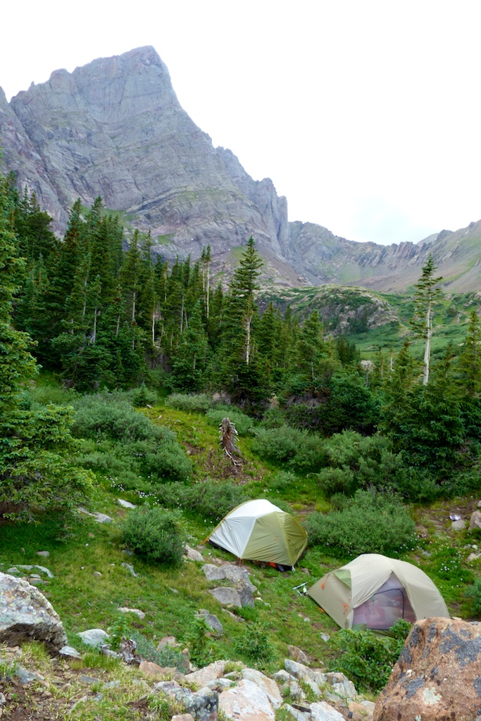
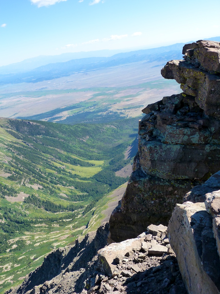
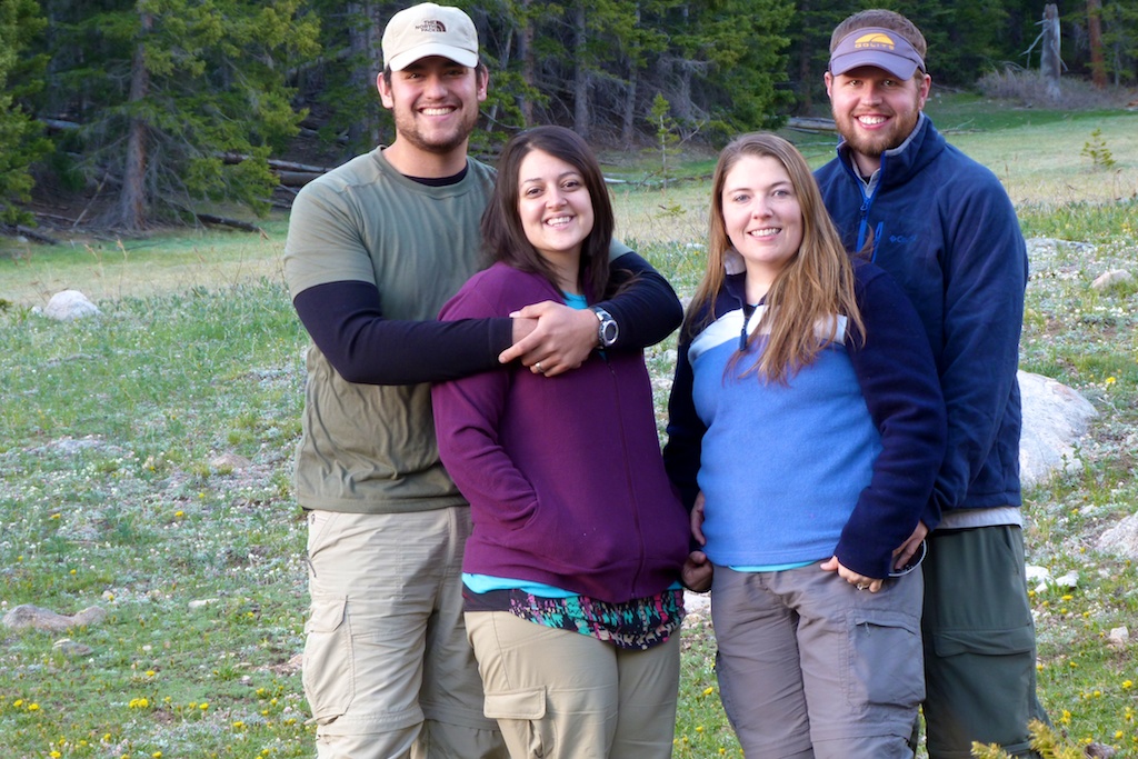
I elected to spend my 33rd birthday camping in the South Colony lakes area, and climbing the 14er Humboldt. We met up at the lower 2wd trailhead and made the bumpy but uneventful drive to the upper trailhead. The drive took about 20 minutes. We arrived at the upper trailhead around 10AM on Friday morning. We promptly deployed some mothballs (to ward off marmots / porcupines), and readied our packs. The upper trailhead has 3-4 nicely developed campsites. The sites have a flat tent platform and a steel fire ring with grates. There is one site that is maybe .10 of a mile down the trail just across the bridge. There are also at least a half dozen good dispersed sites along South Colony Road. At the trailhead there are no trash or toilet facilities. When we signed in at the register there was a poster saying that they were going to start charging a $20 fee for using the area in the near future so you may want to check the status of that before heading to the trailhead.
The hike up the old 4wd road was pretty easy we took our time and enjoyed the beautiful surroundings. At approximately two miles we hit the “shortcut trail’ that is marked as a pack trail on topo maps. There is a sign here although I think it is a bit misleading. The sign indicates that the trail leads to upper lakes / Humboldt. You can also use this to access the lower lakes and Crestone Needle.
We started seeing campsites somewhere around 3 miles in we decided to keep hiking as we wanted to camp near the upper lakes. We hiked around and surveyed over a dozen good sites before settling on this one. We picked it because it was sheltered / private, yet had good views with access to water. There are a lot of good sites up there however; many of them almost have a campground feel as they are well developed and quite close together.
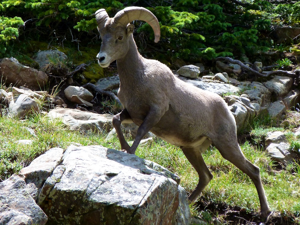
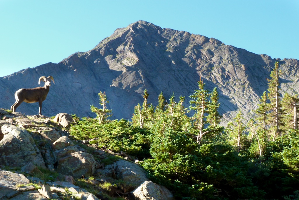
While hunting for a site I ran across a heard of bighorns including a baby. They were scavenging around someone’s campsite.
We spent the remainder of the afternoon lazing around camp. A couple of thunderstorms blew through in the afternoon. Wow they really move in quickly up there, and the needle blocks your view to the west where they come from. By the time you can see the clouds you have 15 minutes until it is over you.
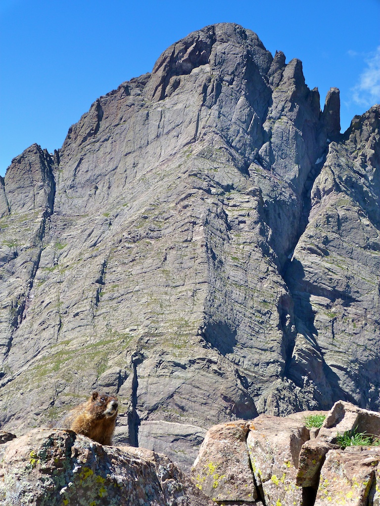
We turned in early so we could get good nights sleep. Although our camp was hidden from view of other campsites we could hear nearby campers enjoying campfire conversations. At 4:30 AM my slumber was rudely interrupted by the marimba sound emanating from my iphone. As I fumbled around in my tent pocket to snooze it, I could hear the wind blowing hard in the trees above us. We decided we would sleep for another half hour and see if the wind would die down. Reluctantly we extracted ourselves from the warm sleeping bag around 5AM. I went down by the creek and snapped couple of pictures of the Needle as the glow of the pre dawn sun warmed it.
We hit the trail around 6AM. The wind had died down and it looked to be a near perfect day for hiking. I noticed the needle reflecting in the creek below the lower lake. The contrast was to high to get a good picture (this would be a great spot for an alpenglow shot)
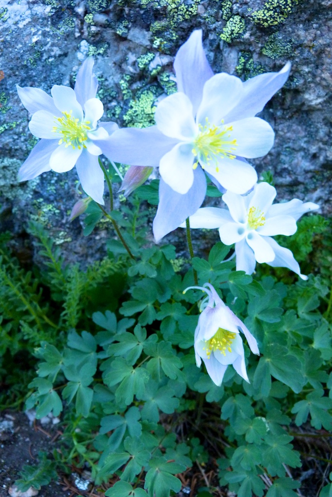
Soon we passed the upper lake and the trail steepened as it began to climb the saddle. As others have noted the CFI has really done nice job improving this trail. I can’t imagine how much work it took to place all those steps. On the way up the ridge we passed some nice wildflowers. They were a couple weeks past prime but still very pretty.
We took our time enjoying the view from the trail. We reached the saddle and took a break around 7:20. We got our first views of North Colony lakes here. There was a little wind, but less than I expected.
After leaving the ridge the trail gets even steeper and rougher. I stowed my trekking poles as they were just getting in the way at this point. The trail to the false summit soon turns into a fun scramble over a large boulder field. Really the only thing to be careful of here is the occasional loose rock. There are cairns marking a pretty easy route through the boulders, but there are endless options of class two routes. Really you just need to meet up with the ridge line on the other side of the false summit. Angela was somewhat freaked out by the scrambling and so we took quite a bit of time making it up to the ridge.
As we reached the home stretch we paused to get some pictures of Humboldt’s impressive north face. A group of four that passed us on the saddle stopped to say hi as they returned from the summit (We had only seen one other group all morning)
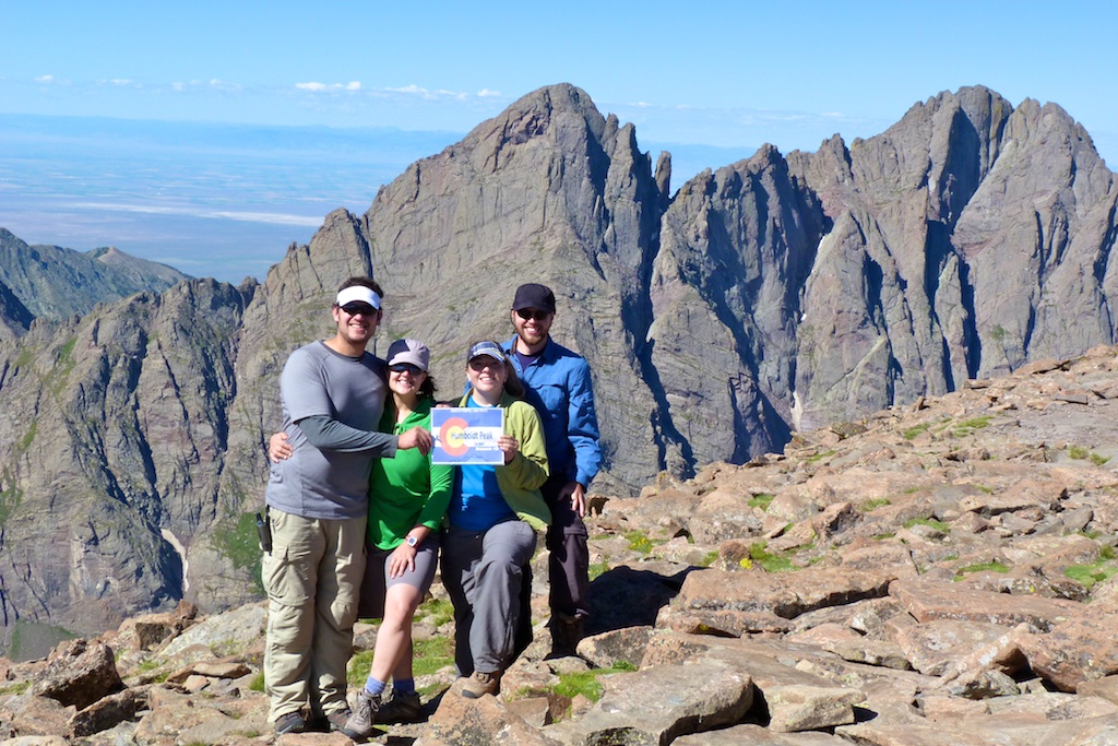
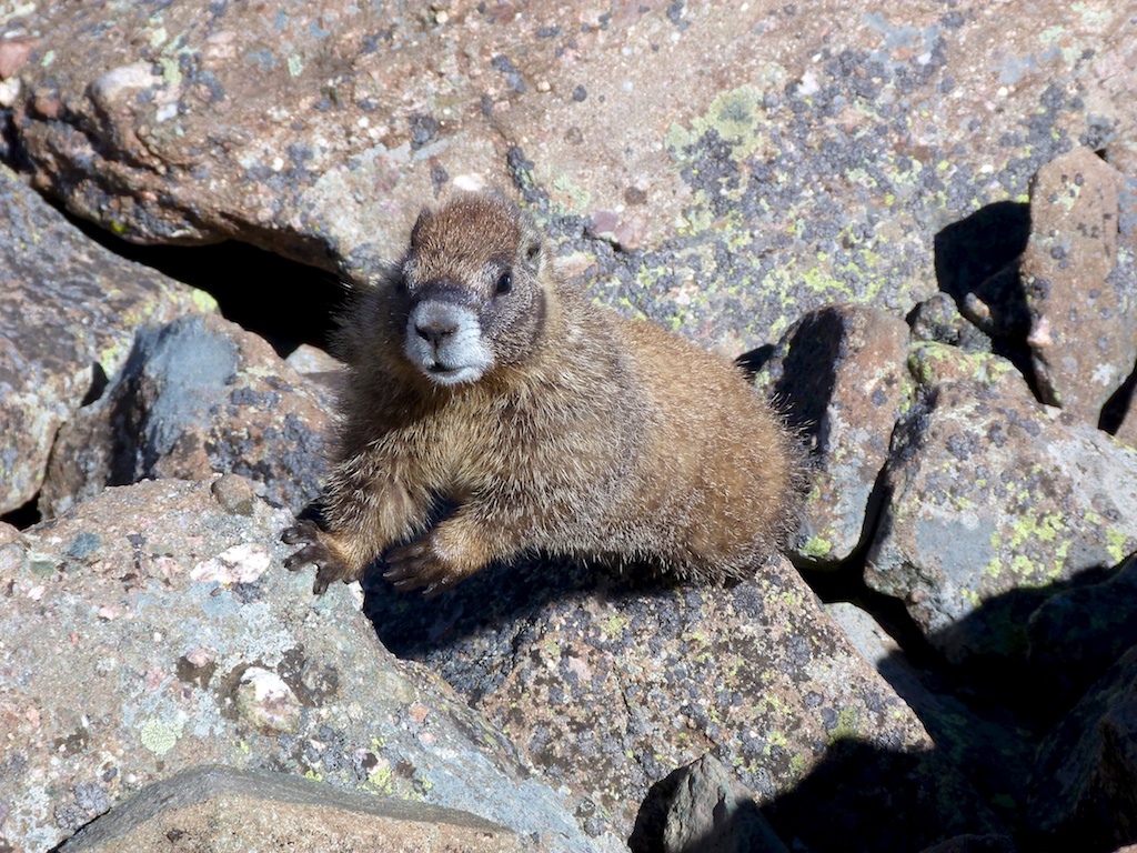
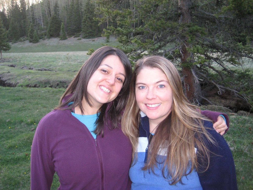
From the false summit there was a short scramble to the summit. The summit of Humboldt was quite large and had a nice wind shelter. The weather was PERFECT hardly any clouds and dead calm. We shared the summit with a few marmots and pika that came to help celebrate Erik & Steph’s first 14er summit.
The return trip was relatively uneventful. We made good time although it seemed like a longer hike on the way out. We passed 3-4 more groups making their way up the trail
Upon reaching camp we traded in our hiking boots for sandals and headed up to the lake to eat lunch and fish. We enjoyed a lazy afternoon at the lake, and an evening around the campfire.
There were fewer people camping at the lakes Saturday night.
After a great nights sleep we packed up the tents. As we were packing a few big horn sheep showed up to bid us farewell. Sad that the weekend was already over we waved goodbye to Crestone Needle who had stood guard over our camp. We reluctantly shouldered our packs and forced our aching quads to make the 3.5 mile hike back to the cars.
This was just a spectacular weekend. It is impossible to even come close to capturing the beauty and grandeur and beauty of this area. I look forward to one day returning to tackle the harder peaks in the group.
You probably clicked this article hoping for a secret easy way to lose weight. Unfortunately I don’t have some big secret, however, I hope you will enjoy my story. I think it will show you that you can lose a siginifcant amount of weight, change your life, and have a great time doing it. If you read to the end I will give you some unsolicited advice on how you can make similar changes in your life.
How I Got Fat I am a Colorado Native, who grew up in the Colorado Springs area. I have always been a husky guy. My parents love the mountains, and we spent lots of time playing in the great outdoors when we were kids. This level of outdoor activity kept my weight somewhat in check.
After College I was lucky enough to land a great job with Lockheed Martin. The unfortunate darkside of this job was that it meant long hours of sitting in front of a computer. After the long day I would come home crack a beer and plop down in front of the tv. This pattern of course, led to pound after pound slowly sneaking onto my body. I moved to Caste Rock, and my level of activity continued to decrease. I had somehow all but forgotten my love for the outdoors. It was now replaced with a love of food and TV.
The pounds kept piling on and I had just resigned myself to being a ‘Fat Guy’. In the fall of 2009 I was staring 300lbs in the face. That was a scary prospect. I started to make some small changes which resulted in losing a few pounds over the next few months. In March of 2010, a routine doctor’s visit noted that my blood pressure was getting pretty high for my age.
I started thinking about the fact that I was working hard to invest money for my retirement, but I was not investing anything in my health to ensure I could enjoy my retirement. The time had come to deal with the problem.
How I Fixed It I knew from past experience that a diet and gym was a path to long term failure. So instead I tracked my calories and analyzed my life to figure out what the biggest problems were. Slowly I made small changes that I knew I would be able to live with for the rest of my life. This included reducing how often we were eating out, adding in healthy fresh food, and giving up alcohol. Of course another obvious problem was my completely sedintary lifestyle. Having a unique distain for hours on the hamster wheel (treadmill), I knew I needed to be active outdoors in order to have success. I knew I used to love hiking, golf, and riding my bike. So I started out slow with some easy hikes. I increased the amount of time I spent outside by 10 fold. I didn’t worry about what I was doing, as long as I was being active and enjoying myself. Sure enough the pounds began to slowly slip off.
My first symptoms of the 14er bug bite appeared mid summer 2010. I had been on 14ers as a teenager, and I remembered how much fun it was. I set a goal to get in shape to climb 14ers, and so I began training. I was still really out of shape, and I thought tackling a 14er that year would be irresponsible. Instead I set a year long set of goals that would get me in good enough shape to enjoy myself and be safe. I started with 3-5 mile hikes in the foothills around Castle Rock. At first it was 300’-400’ elevation gain per hike. By the October I was 50 pounds lighter and able to do the infamous Manitou incline in a little over an hour.
I also read and researched to keep motivated. I bought “Mountaineering: The Freedom of the Hills” and spent a lot of time studying it. I checked out dozens of climbing books from the library. One of them I particularly enjoyed was Halfway to Heaven. I enjoyed it enough that I got my wife Angela to read it as well. After months of hearing me babble I could tell that she to was getting intrigued by climbing. Halfway to Heaven talks a lot about the website 14ers.com . I joined the site and found a great community of local hikers and climbers that were very motivated to climb the mountains that surround us.
Throughout the winter I continued to hike, and we got back into snowboarding. We bought microspikes and snowshoes so that we would be able to stay out in the winter conditions. By January I had shed 70 pounds and I knew climbing would be much easier this summer. I wanted to increase my cardio capacity so in February I started the Couch to 5k running program. I completed my first 5k at the beginning of April. The training was tough, but I could really feel the difference when I was out on the trail.
Where Am I At Today In March I bought a new bike, and really got into cycling as well. I found it to be my second favorite activity behind hiking. It was also much easier to do on a daily basis, and again I noticed a difference in my endurance on the trail. By mid summer I was riding 30 miles on the bike, had run a sub 30 minute 5k, had a 47 minute time on the Incline, and was hiking harder and harder trails with increasing ease.
In July I finally stood on top of a 14er. The mighty Mt Elbert, the tallest one in Colorado. All the training had really paid off, and the hike went better than expected.
For us the journey is just beginning. There are more mountains in Colorado than I can hope to climb in my lifetime. Many of them are far beyond my current technical and physical abilities. This means I have many years to get in progressively better shape. Which is now an exciting prospect.
I have lost a total of 112 pounds since September of 2009. Here is a picture of me on July 4th.
Tips So I wouldn’t want to leave you with out some lessons I learned along the way.
There are two types of pain. The pain of discipline and hard work, and the pain of regret. The first pain is temporary and will be replaced by the pleasure of accomplishment. The latter will eat at you for a long time in a very uncomfortable way.
You won’t be successful unless you set goals. You need to set some really lofty long term goals. Something that seems almost impossible. Then set lots of intermediate goals that when combined will get you to your big goal. This gives you plenty of successes to celebrate along the way. You need to move slowly, but at the same time push yourself hard. You will soon be amazed at what you can do.
Find a motivated partner that has similar goals if possible. Victory is even sweeter when you have someone to celebrate it with.
Make small incremental changes in your life. Every few weeks look at your habits and try to eliminate the worst of what you are doing. Make better bad choices, and make all of the changes permanent. Small changes coupled with a lot of time lead to some really big results.
I know this isn’t going to be popular, but you should drastically reduce your alcohol intake.
Alcohol is full of bad calories.
It reduces your body’s ability to metabolize fat. Your liver learns to prefer it as fuel, and stores fat.
You are far more likely to make poor food choices after drinking.
Even a small amount of alcohol the night before a big activity will reduce your peak performance. A lot of alcohol, and you will probably just stay in bed instead of hitting the trail.
Alcohol messes with your sleep, and dehydrates you. Sleep and hydration should be top priorities for anyone seeking a fitter lifestyle.
The things we think will make us happy in the short term, are really the enemies of our long term happiness. When the alarm goes off on a cold day, I feel as if nothing would make me happier than shutting it off and skipping my workout. Once I get going and complete the workout I have a much happier day than if I had chose to stay in bed. The same is true with your food choices. Even though it seems that second cookie is really what you want, it is the enemy of your long term happiness.
Take advantage of techology. I used several Iphone apps to help me with my weightloss. I track all of my workouts using runkeeper, I track and analyze my food using my fitness pal, and foducate.
Don’t go on a diet, but do work to make healthy food choices. You should not deprave yourself or follow a strict diet. That does not mean you don’t need to change your eating habits. It takes work to find healthy foods that you like It is completly possible to enjoy your food and feel satisisfied while loosing weight. Food is the fuel your body needs to rebuild itself so learn about and pay atenttion to what and how much you eat.
I hope you have enjoyed the article, and perhaps it will motivate you to do something better for yourself. I know I am very happy with my choice to change my lifestyle.
These are some ideas for trail food you can take with you backpacking or on day hikes.
General Tips
If you are out for more than a day hike you need to really consider weight, and perishability of your food. This means dehydrated / freeze dried food rules. You will be expending a lot of calories so you want to eat high calorie foods. You know, the stuff you are supposed to stay away from at home.
Eat a very big breakfast the day you leave and plan for a big dinner on the way home. This reduces what you carry
Pre portion your food use a combination of drysacks / plastic grocery bags / ziplock bags to portion your food. Splitting into a grocery bag for each day makes it easy to find your food, and keeps you from accidentally overeating early in the trip.
Don’t forget to hang your food & trash in a bear bag or bear canister.
Packets of olive oil or canola oil are a good way to add healthy calories to lunches or dinners.
You should focus on getting plenty of carbohydrates, they are the primary source of quick fuel. They will also help tired muscles replenish glycogen for the next day’s hiking. Fat is a good way to up the overall calories, eating fat before bed can help you stay warm at night.
Breakfast
In winter or shoulder seasons a warm breakfast is a good start to a day in the outdoors, it may be worth the time and effort to heat breakfast.
Cliff Bars or granola bars make a great easy breakfast
Bagel with cream cheese (set it on top of kettle while making coffee to get it warm)
Instant Oatmeal (consider nuts, raisons / dried fruit to improve) [Also bring ziplock bag to line bowl with, then you can just throw away when done)
Cereal with dehydrated milk
Pancakes
Dehydrated breakfast meals from Mountain House or Backpackers Pantry
Pop Tarts
Honey Stinger Waffles
Via instant coffee from star-bucks makes a great tasting cup of coffee in the morning. It is already pre-packaged in convenient single serving packs
Lunch A common lunch strategy is to simply graze on snacks all day long. This avoids the time and effort of unpacking and preparing lunch. I personally prefer an actual lunch, but I try to make it low fuss.
Summer sausage and hard cheese (this will keep for a couple of days) Good with crackers
Flatout wrap or tortilla with – (hummus, turkey, cucumber, tomato, cheese)
Flatout wrap or tortilla with – chicken, avocado and smoked salmon cream cheese
Flatout wrap or tortilla with– peanut butter and dried apples and a sprinkle of roasted pumpkin seeds (the green kind without the shell aka pepitas), some honey
Flatout wrap or tortilla spread with Gnutella & then toss in some banana chips as a wrap
Hot soup in a thermos (this is a real treat on a cold day)
Cold Pizza (only good for a short day hike)
PB&J on Pita bread (better than regular bread because it won’t squish. A good tip is to put your PB&J in a ziplock bag. You can then just cut the corner an squeeze onto your bread when you are ready to eat.
PB&J bagel
Savory bagel (onion / everything) with cucumbers tomatoes, and savory cream cheese
whole grain bagel with thinly sliced apple and gouda cheese.
Cold KFC (only good for a short day hike
Lunchable – only good for day hike
A pouch of tuna with crackers
Mini-baguette sliced in half, drizzled in olive oil, plus sea salt, ground pepper and rosemary
Sea Bear Smoked Salmon with crackers or chibata bread.
Mountain house chicken salad (just add cold water) with a tortialla or bagel.
Snacks
It is always good to have a mix of salty and sweet snacks. After a few days of trail mix, and candy sweet food starts to sound pretty disgusting. A good variety of flavors making sure you include some savory options can help avoid this.
Bananas / coconut milk are a great pre hike snack. They will give you calories and electrolytes.
Trail mix (there are tons of varieties in trail mix, it is a great choice because it is low weight high calorie and easy to eat)
Nuts (there are lots of nut mixes that can vary the flavor and range from salty to sweet to spicy)
Coconut Almonds and dried pineapple (yeah its just trail mix but yum!!)
Nut butters (justins nut butter or pocket fuel) [Note these don’t do well in cold weather]
Cheetos (these do much better in a pack than potato chips)
Pringles (the can keeps them in good shape) (note they do sell short cans of these)
Crackers (Tougher crackers such as triskets or wheat things survive better in the pack)
Fruit Rollups, fruit leathers or cliff kids
Dried fruit (bannana chips, dried apricots, dried mangos, dried apples)
Cookies (the hard varieties do better in a pack)
Candies such as gummy bears, orange slices, hot tamales, twizlers (these all do well in cold weather)
Candy bars (snickers are great frozen)
Jerky (I prefer the kinds that are not super chewy as they are faster to eat and don’t get stuck in the teeth as bad)
Apple
Energy bars(Cliff, Luna, Laura are all popular) [some of these turn to real hard bricks in cold weather]
Protein bars (these are a nice filling snack, again cold weather can turn these into a rock)
Energy Gells / blocks (shot blocks are the best in my opinion)
Cytomax / gatorade / hammer nutrition … (I keep a week solution of this in my camel back for a constant suply of energy and electroliytes) http://www.cytosport.com/products/cytomax. I prefer the powder kind because I can bring it in my pack and mix more on a multi day trip.
Sharkies organic fruit chews
Date balls- grind up dates and walnuts add cocoa and coconut
yogurt or chocolate covered pretzels
Dinner
For dinner you should consider dehydrated food. Many of these such as Backpackers Pantry, and Mountain house are cheep and really pretty darn good. If you want to reduce the sodium and the cost you could consider buying a deyhdrator and doing it your self.
Some other choices for dinner
Instant mashed potatoes
Ramen noodles
Cup o soup
MRE’s (available at military surplus stores and online)
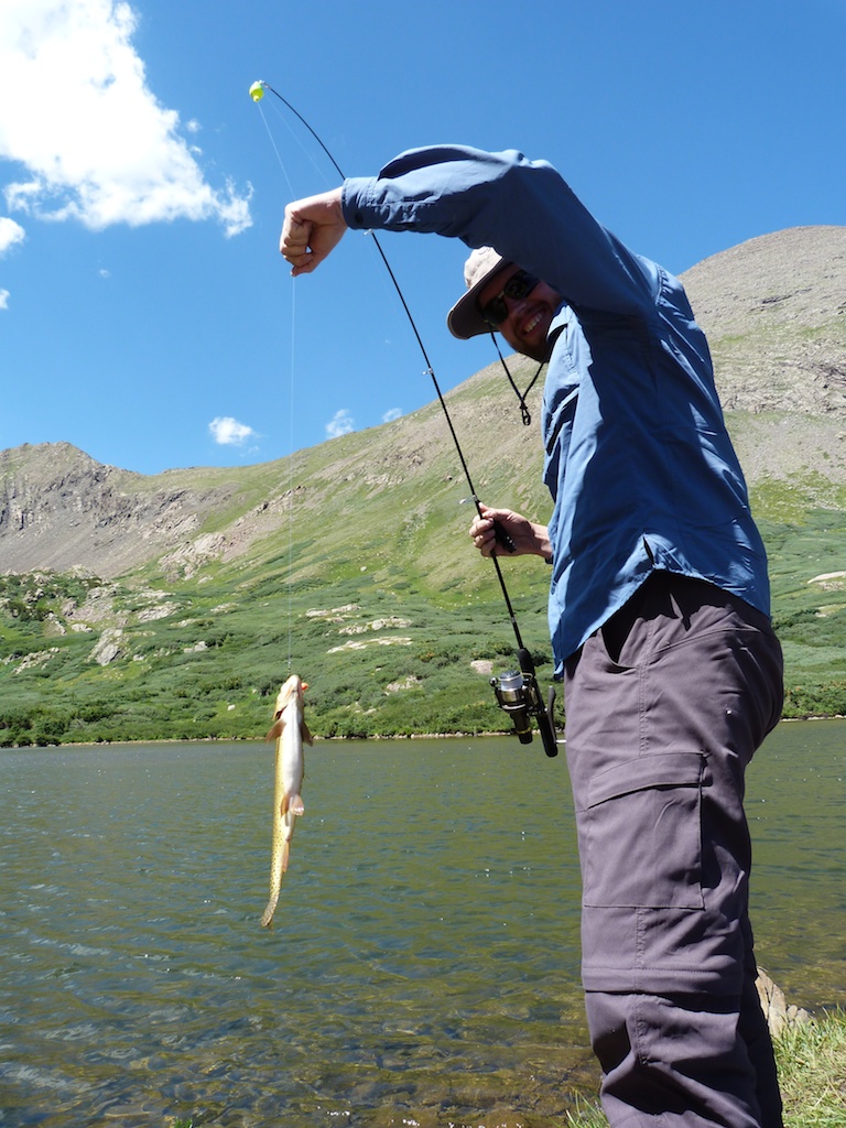
Fresh caught fish.
Thanks to the users at 14ers.com who provided some of these ideas.
Most hikers are out there seeking that next high. We are after the zen that is that perfect un-discovered trail. We know a good trail when we have hiked it, yet we often don’t stop to think what makes a trail great. This post offers my opinion on what makes a hiking trail stand out.
Scenery This is perhaps the most important factor in a really enjoyable hike. It is tough to dislike any hike that shows off natures beauty in a unique and interesting way. Some areas of Colorado (like the San Juans) offer breath taking scenery on almost every hike. In many other areas, you have to look a little closer. I have found that I enjoy some of the front range hikes more on my second or third visit. Perhaps a different season has increased the beauty of the area.
Payoff I try to subscribe to the philosophy that it is all about the journey, not the destination. However, it is just more satisfying when the best scenery is at the apex of your hike. It makes it seem like it was worth putting in the effort, and sticking with it to the finish. Some of my favorite payoffs are: a stunning summit view, a thundering waterfall, a tranquil alpine lake, or a flower filled meadow.
Variety Nothing makes the miles tick by like a new discovery around every corner. This is why I love hikes with lots of variety. Some examples of changes that keep a hike interesting:
Breaking out of timberline to alpine tundra
Good lookout spots with views as you climb the side of a mountain
Changes in forest types from pine to aspen …
Crossing through a nice meadow
A trail that occasionally flirts with a stream or river
Wildflowers along the trail,
Coming across a mountain goat, marmot, or moose
Climbing out of a canyon onto a ridge-line
Challenge For some reason nature’s beauty is more enjoyable if you had to work hard to see it. As strange as it may seem to the non hiker, the aching feet and sore butt are a sure sign of a great hike. This is always a moving target, as you get in better shape you will constantly seek harder hikes.
An exciting creek crossing, or a hands on scramble are also add a fun challenge to any hike. If it is a little bit scary, and a lot hard, you will probably be glad you did it when it is over. “The Challenge” is why climbing Colorado’s 14ers is so popular.
Solitude Solitude is abundant in the wilderness, it is the reason why many of us are drawn to the wild. However, when it comes to great hikes solitude can be hard to find. When we find a really great hike, we want to tell the world about our discovery. Some of us blog about it, some tell their friends, and others write guide books. In any case, the word gets out about the really good trails. Thankfully this does not mean that your desire for solitude is for not. You can still find great trails that also offer solitude. You are just going to have to work a little harder, and do it differently than everybody else. Here are my tips for reducing your company while hiking outstanding trails.
Not all great trails are popular. If it is in every guide book, and listed on tripadvisor it may be a great trail, but everyone else will be out hiking on it. There are many really good trails that few people know about. The internet, and local sports shops are great resources to find these hidden gems.
Try a different season. Many people have not yet discovered how great it is to hike in the other three seasons. This is especially true for lower altitude trails. You will avoid the 90 degree heat, and see much fewer people if you go in the off season. Plus you get a different perspective. The same hike is often completely different in each season.
Get up early on a weekday. Weekend warriors clog the trails on Saturday and Sunday. If you want to be alone get up really early on a Wednesday and do the hike. I often hike before work in the popular Roxburough state park in Denver. I may run into one other person on the whole hike. On a Saturday afternoon you can’t even find a parking place. Early morning is also the best time to see wildlife, and offers some the best light for taking photographs.
Another great way to get solitude is to go farther. This means driving far away from big cities, and popular tourist destinations. Once at the trail head hiking more miles than the average person. This extra work will payoff with the peace and quiet you desire.
A Few Examples of a Great Hike Coming up with a great example is tough. There are so many outstanding hikes in Colorado. This hike to Ice Lake Basin in the San Juans is a good example of a great hike.
The Colorado Trail has it all, and is unarguably a GREAT trail. However, at 500 miles long the great is mixed with the mediocre.
This relatively unknown hike to Browns Creek Waterfall in Salida is another good example
If you have a better example please share it in the comments. I would love to go hike it and judge for myself.
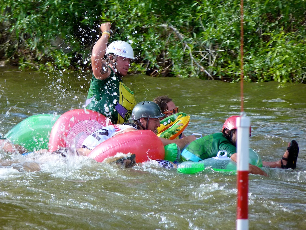
June 2011 We went to Salida Colorado for a whitewater festival called FIBARK (First in Boating the Arkansas).I found this festival when looking for 5Ks to run in this summer.
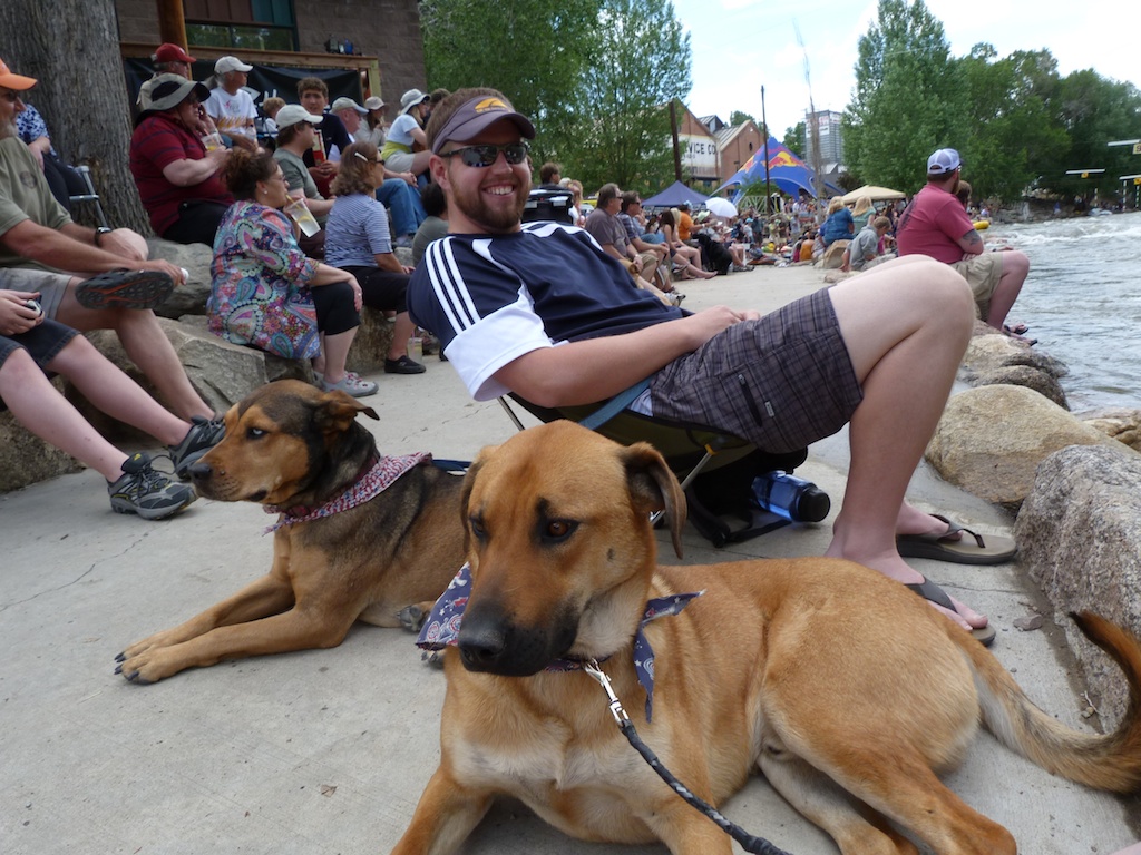
I wanted a good night sleep before the race, so we decided to stay at a B&B instead of camping.We selected the Mountain Goat Lodge just north of Salida.It was a really nice Bed and Breakfast.The owner Gina keeps a bunch of goats and chickens on the property, which provides some entertainment.She also allows dogs, which is what really sold us on the place.The property itself is not all that pretty, but it has some really nice views of the surrounding mountains.
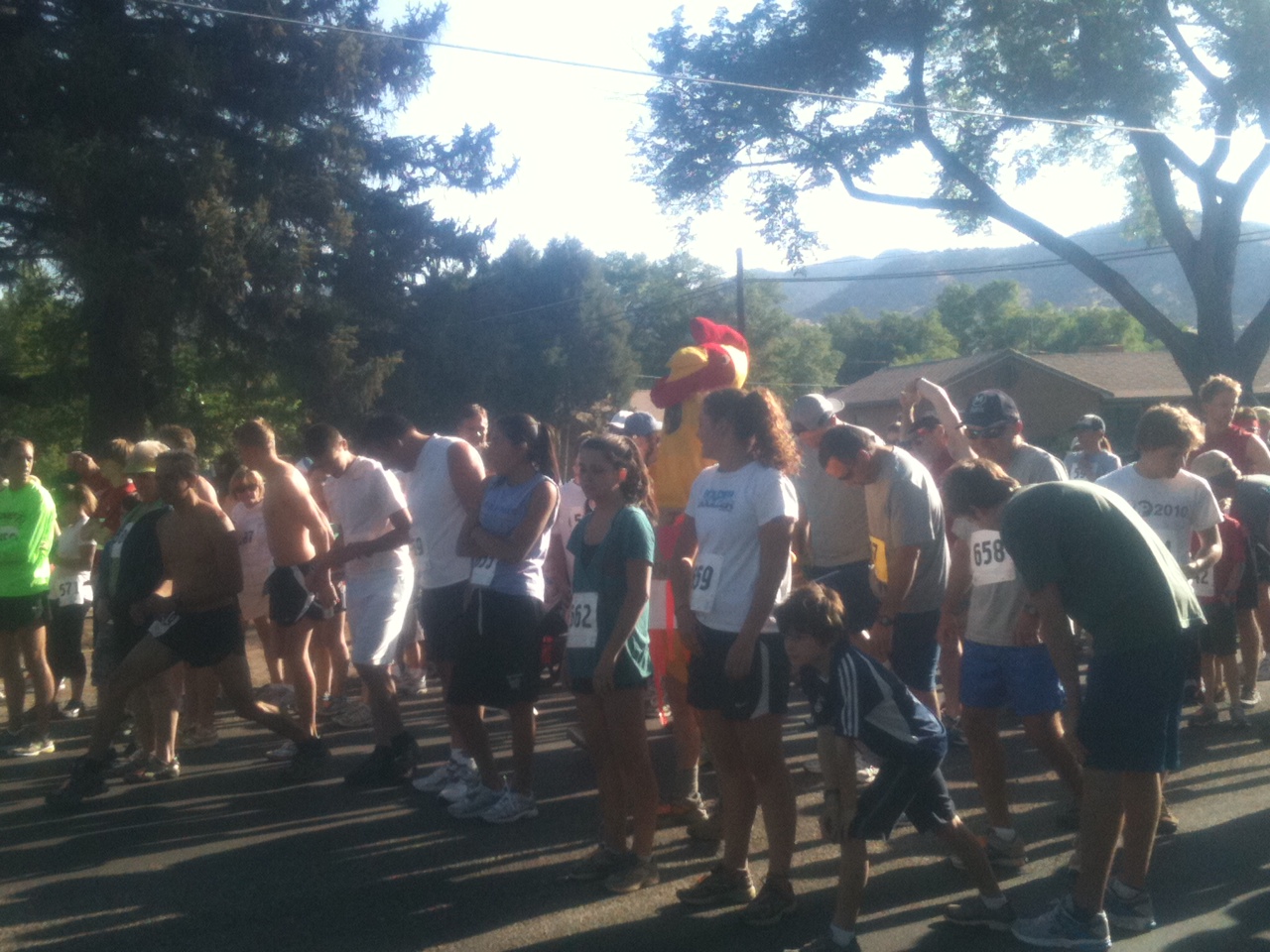
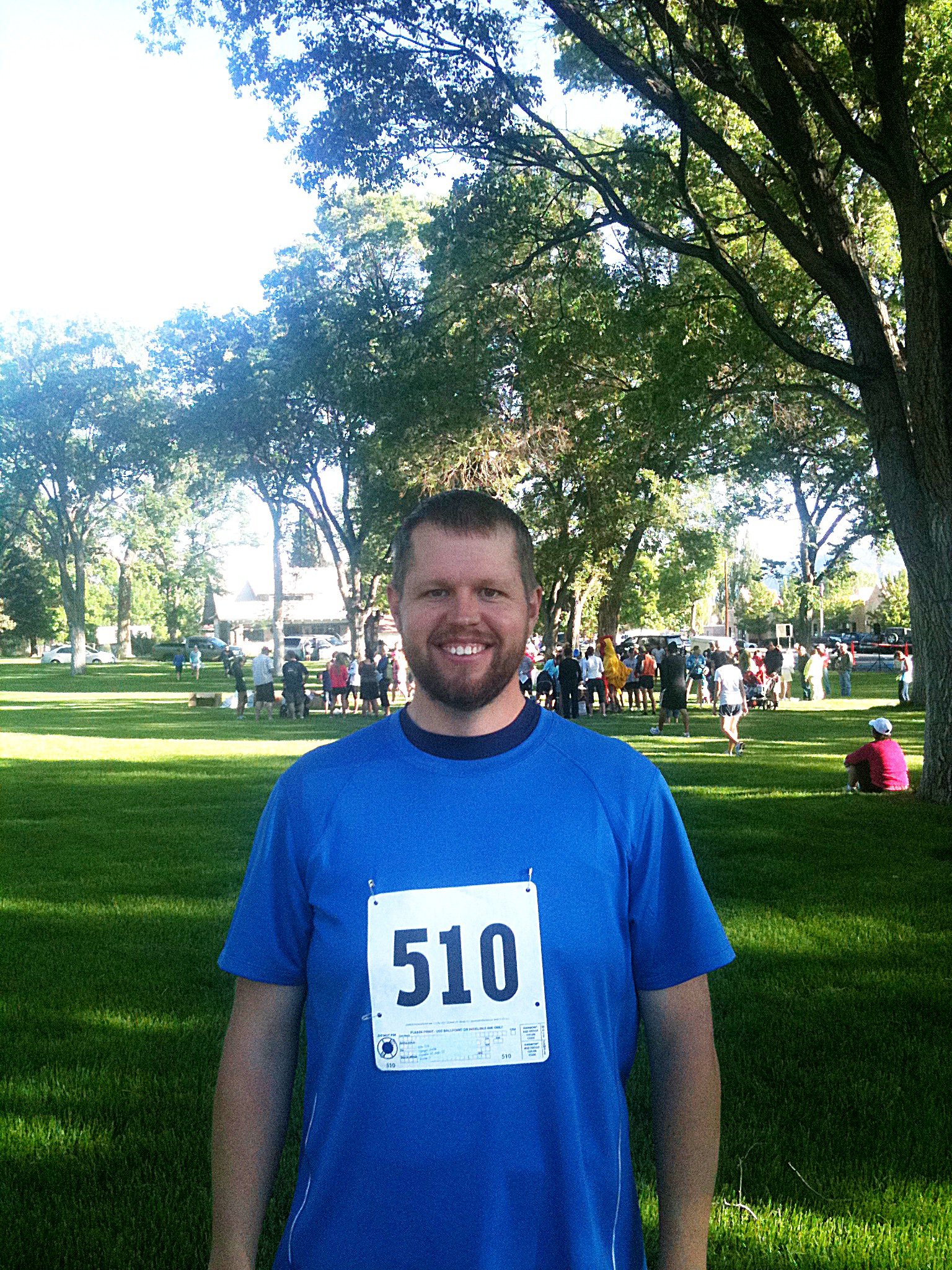
Saturday morning was an early one.We left the blinds and windows open to get some fresh air, so we awoke with the sun.We got ready and headed to town for the 7:30 AM race registration.Overall the race went well. My goal was to break 30 minutes which meant I had to push myself really hard.I was running an app on my iphone that allowed me to monitor my pace, so I knew I was running fast enough I should be able to break 30 minutes.As the finish line came into sight I spotted Angela.She was yelling and motioning for me to hurry up.I was exhausted and already running as fast as I could, but I tried to push it just a little bit harder.I crossed the finish line in 29:56 just barely meeting my goal.I sat down in the grass and rested as other contestants came in.The 10K winner crossed the finish line just 4 minutes after me! I can’t imagine running twice as fast as I just did.
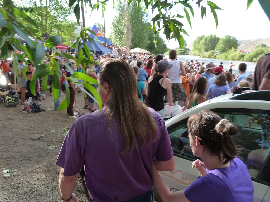
After some relaxation and a shower back at the B&B, we headed for FIBARK down at the riverfront.The festival was in full swing. There was music, food, beer, and lots of fun to be had.We found a clear spot on the Arkansas River and watched the free style kayak, and stand up paddling competitions.We met up with our friends Jon and Kassy around 3, and did some window-shopping in downtown Salida.
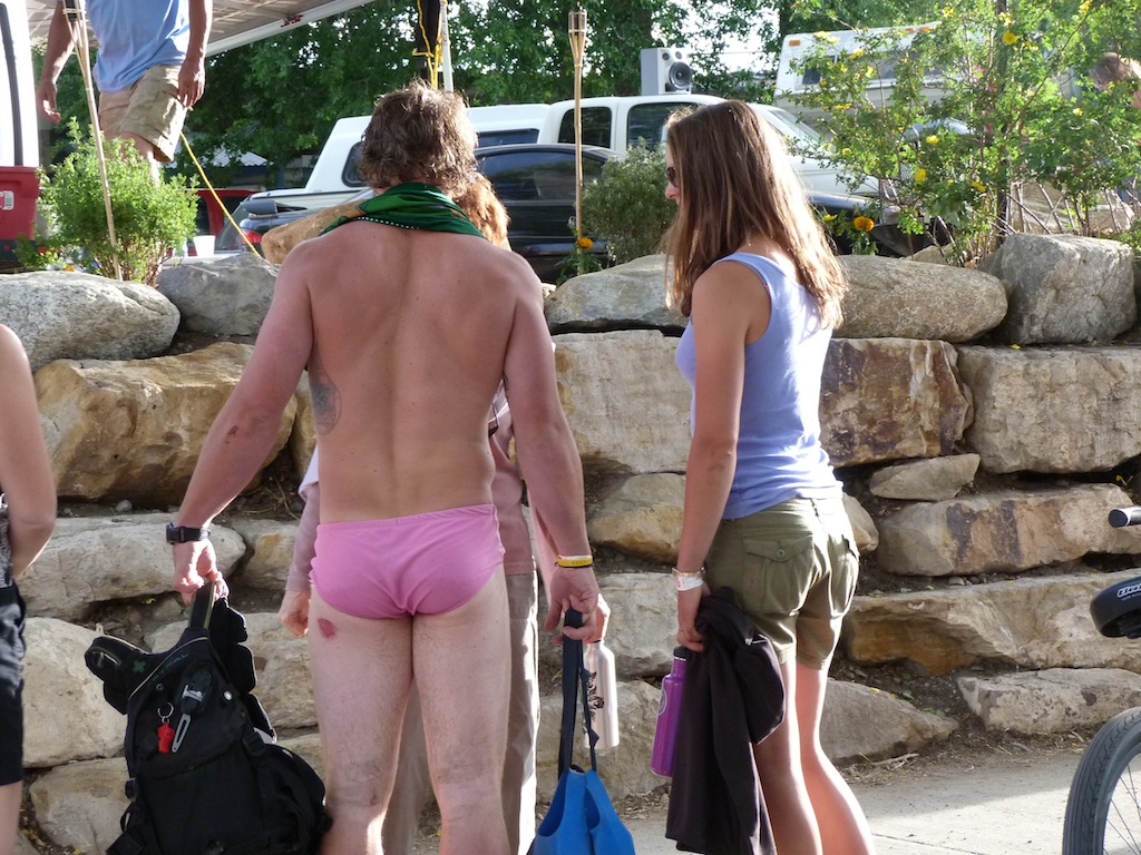
The highlight of the festival is the Hooligan Race.In this event contestants dress up in costumes, and ride their crazy homemade contraptions through the rapids.Much to the delight of the crowd, many of the boats end up coming apart in the rapids.In between waves of hooligans we had a great time people watching.Overall this was a really fun event!!
Sunday morning we enjoyed a leisurely breakfast at the B&B. Since Gina has goats, she offers some goat related breakfast items.I enjoyed a goat’s milk latte, and some goat yogurt with strawberries.
After breakfast we packed up the car, and headed up 285 to do some hiking.Our goal for the morning was to hike up to a waterfall off browns creek.This turned out to be a really outstanding hike.There was good scenery the whole way up, and the falls were spectacular.I would highly recommend the hike.I put together a guide over at everytrail.com
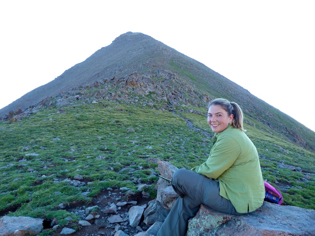
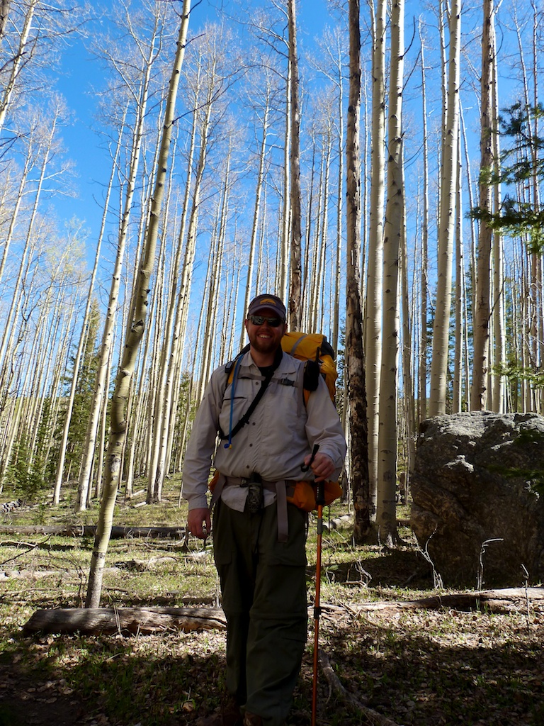
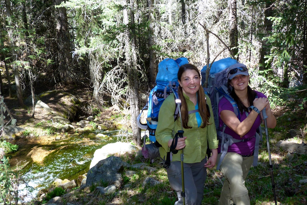
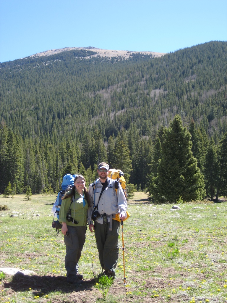
This Memorial Day weekend we met our friends Erik and Steph to do some backpacking in New Mexico’s Pecos wilderness area.Erik discovered the area after moving to New Mexico a few years ago, and was excited to show us some of the alpine beauty this state had to offer.We were originally planning to overnight at a high alpine lake (Lake Katherine), however, we decided it was just to early in the season to camp this high. So we instead targeted La Vega Meadow with a day hike to summit Santa Fe Baldy. We decided to spend the night in Santa Fe Friday night so we could get an early start Saturday morning.
If you don’t want to read all the details of the trip I would suggest you start with the Video
You can view an interactive map of the trip at Every Trail. Or download the GPX file(with routes and lots of useful waypoints)
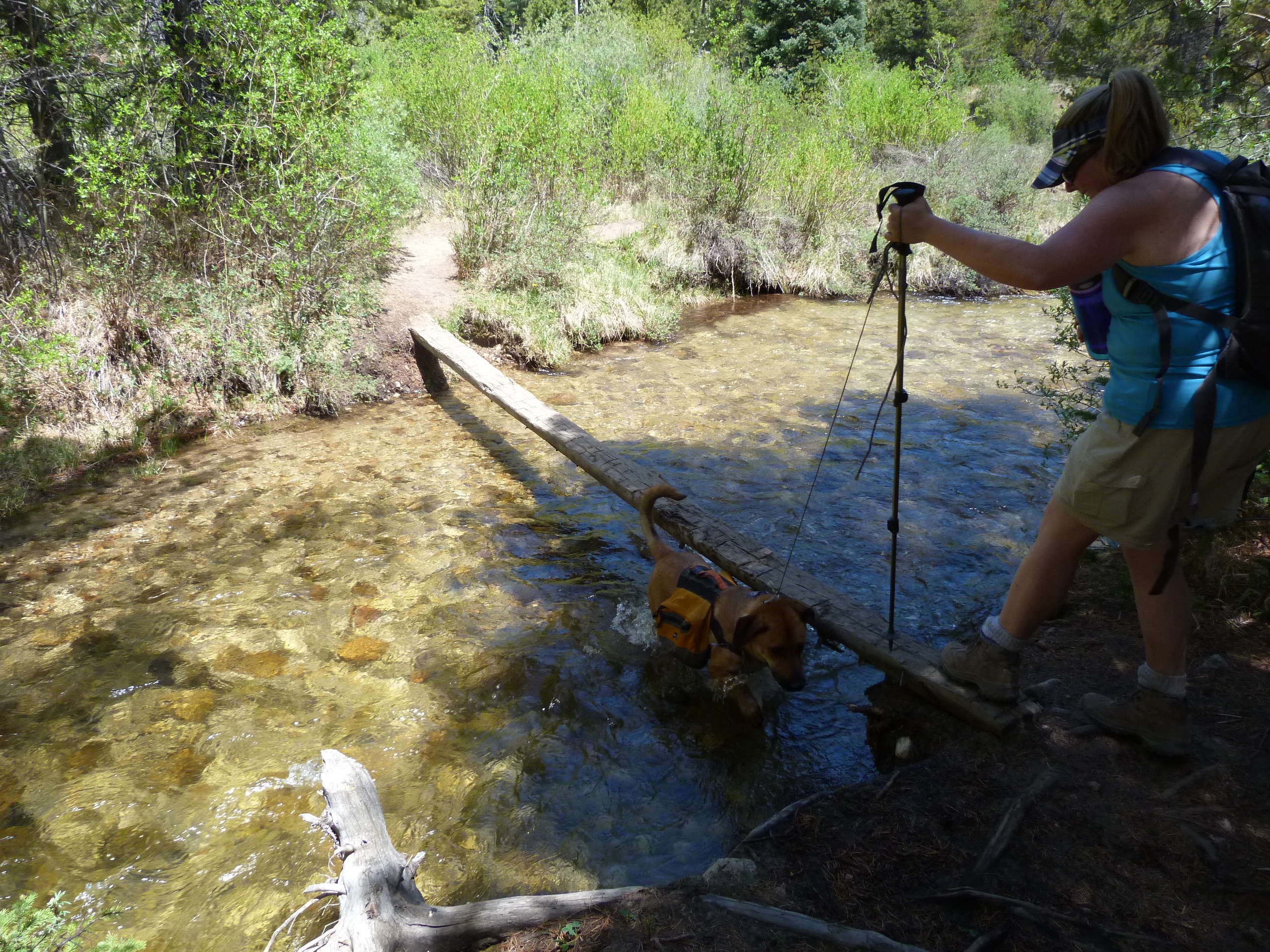
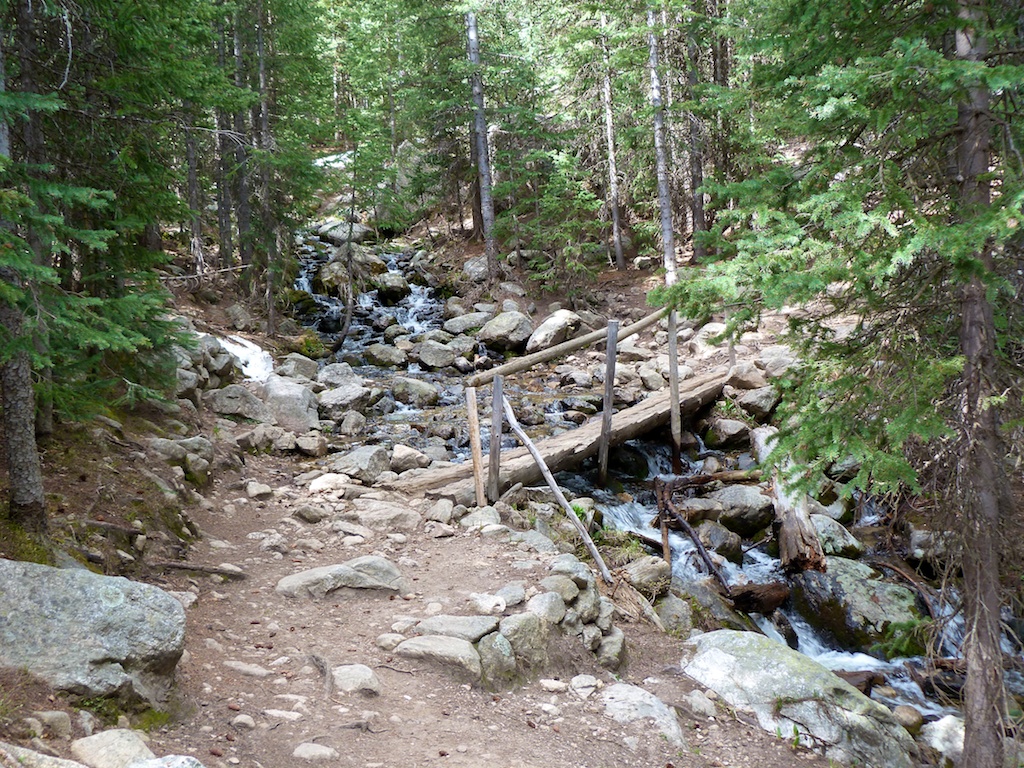
We got up early, grabbed breakfast and started the 45-minute drive up Hyde Park Road. The trail head for Winsor Trail (#254) is at the upper parking lot of Ski Santa Fe (google map).We took advantage of the last toilet we would see for a few days, and then shouldered our heavy packs. The trail doesn’t waste anytime; it is steep right off the trailhead.You climb 600 feet in the first .5 miles of the trail.You will give most of this back over the next couple of miles.At around ½ mile in you hit the boundary of the Pecos Wilderness.We stopped here to sign in. After entering the wilderness you drop downhill to the Rio Nambe. I hate loosing elevation close to a trailhead because you know you will have to climb back out when you are tired. 2.4 miles after leaving the trailhead you will hit the intersection with trail Upper Nambe Trail (#101).This trail serves as a shortcut, and is the most direct route to La Vega. The trail gently looses elevation and eventually meets up with the Rio Nambe.You cross the Rio Nambe via a log bridge. This spring had unusually low runoff. I would bet this crossing could be problematic this time of year.At around 3 miles we hit the Rio Nambe Trail #160.(This trail also intersects Winsor trail).Not to long after joining 160 you will come to a little hill and a clearing in the trees.As the trail breaks through the trees you are treated to a beautiful view of La Vega Meadow.
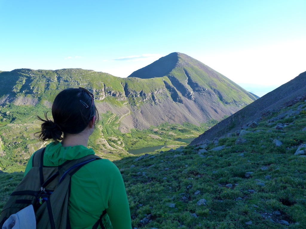
La Vega(“The Meadow”) is a beautiful high alpine meadow.It is said to be one of the nicest meadows in the Sangre De Cristos.Unfortunately we were to early for the wildflower show that paints the meadow from mid June – mid August.Judging by the amount of aspen around the meadow, fall must be something to see in the area as well. Providing a nice backdrop to the meadow is tomorrow’s target, Santa Fe Baldy with its mustache of spruce trees stretching across its bare face.
La Vega provides at least 5 good camp sites that are spread out enough to provide solitude.We were there on a busy weekend and only saw three parties come through the meadow.We selected a site at the very end of the meadow.The site was well protected from the high winds forecasted for the weekend.We wasted no time in getting our heavy packs off and setting up our campsite.After a couple of hours of chores we sat down for a cold lunch.We spend the remainder of the day exploring the meadow and relaxing around camp.
We enjoyed conversation and marshmallows around the campfire as we admired the stars in the clear sky.We headed for bed around 10:30PM.It was remarkably warm (low 50s) when we went to bed.The wind kept gusting into camp, which made it hard to sleep.It would start low in the valley with a sound like an approaching jet.As it hit the camp the trees would sway and bang against each other, and the rain-fly would make a racket.So much for restful sleep before our climb.
Day 2– La Vega Meadow -> Santa Fe Baldy
Due to our poor nights sleep we didn’t get up until after 7AM.Again it was remarkably warm for this time of year.I had to take off my fleece shortly after getting up as I was already hot.We enjoyed breakfast and coffee before getting our gear together for the hike.After reviewing the map we set off down trail 160 towards Santa Fe Baldy
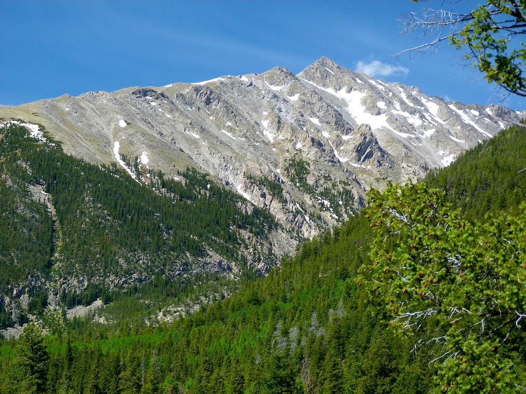
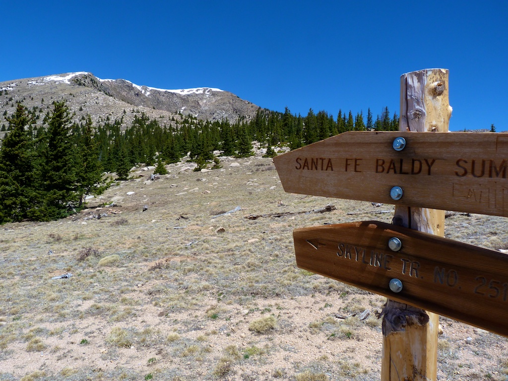
Santa Fe Baldy is a major peak in the Sangre De Cristo range.At 12,632 ft there are no higher points south to the New Mexico border, and the peak stands as the highest in the Santa Fe area.Our plan was to take the Rio Nambe Trail to Windsor and then up to the Skyline trail.This would make for a round trip of around 8 miles and 2500ft elevation gain.If it weren’t a holiday weekend we would have moved camp to Puerto Nambe.
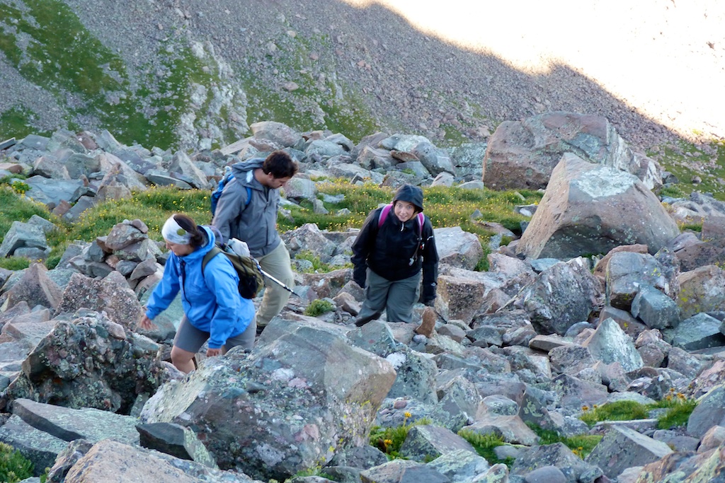
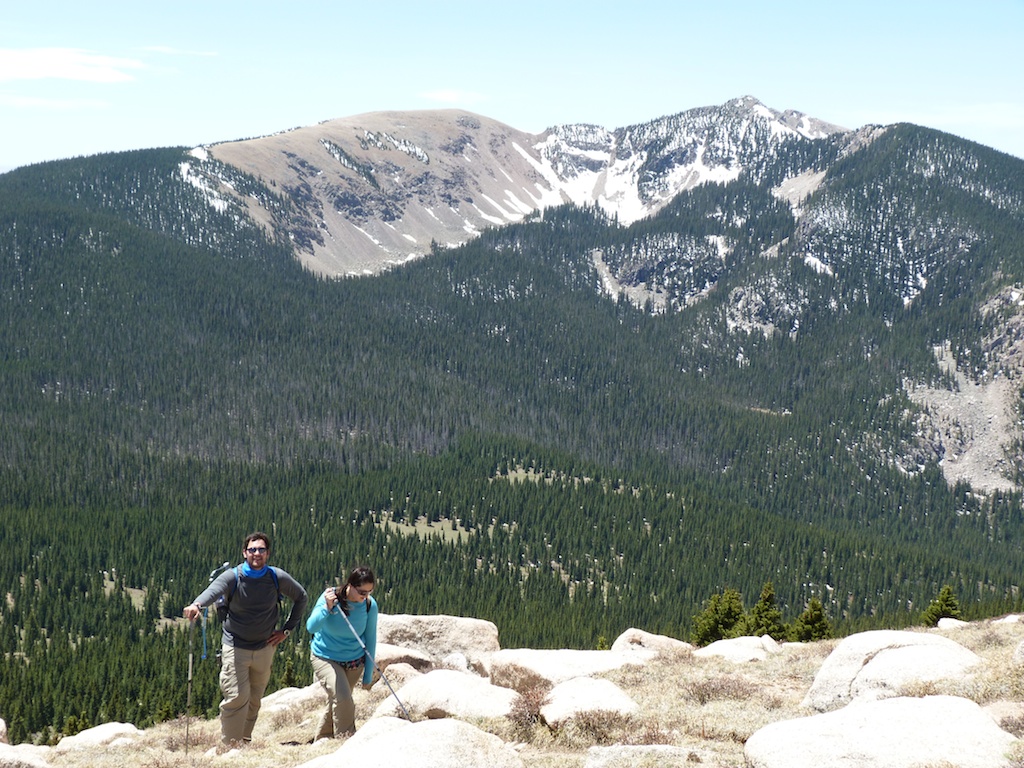
Less than a mile into the hike we lost the trail at a river crossing.We both have Garmens and the map showed a second trail to our north.We decided to take this route (which doesn’t exist).So we spent the next 45 minutes bushwhacking our way towards Puerto Nambe.Finally we broke out into another beautiful meadow called “Puerto Nambe”. This area is a great choice for camping or taking a lunch break.At the meadow, Winsor trail hits Skyline #251 which is the route to the top of Baldy.After leaving the meadow the trail gains 750 ft over 1.3 miles towards a ridge.You will need to time your hike so that you are back off this ridge before afternoon thunderstorms hit.So this is a good time to stop, enjoy the view, and evaluate the weather.In our case we couldn’t even talk in the winds that were howling across this ridge.It was about 11AM and the winds were forecast to really pick up after noon.We took shelter behind a tree and talked it over before deciding to continue up the trail.So we made left turn off the trail (look for the cairn) and simply followed the ridgeline for 1mile 1000ft elevation towards the summit of Santa Fe Baldy.After ½ mile the winds continued to pick up, and we could see a lot of ice / snow on the trail at the summit.We decided the smart thing was to turn around 200 vertical feet short of the summit and return to camp.
We made a hasty retreat down the ridge and back to the protection of the trees below timberline.We made a quick stop on the ridge to spread some of my brother-in law’s ashes (this was the 4th anniversary of his death).Soon we were back at Puerto Nambe where we located some shade, and sat down for lunch.After four hours of hiking it felt great to sit down for a while.
After lunch we finished hiking back to camp (This time we used a trail).We arrived back in camp around 3PM, and immediately headed for the stream to soak our tired feet.We spent the remainder of the day lounging around.We fired up the stoves and cooked up dinner around 7.We noticed the wind had changed directions, and it now had a cold bite to it.We started the campfire before dusk, and headed to bed a little before 10PM.Our hike and a little calmer winds made for a good nights sleep.
Day 3– La Vega Meadow -> Ski Santa Fe
The next morning we got up, had breakfast and packed up camp.We lifted our loads onto our back, and began trudging back down the trail towards Ski Santa Fe.The hike out was pretty consistent up hill with a few steep places.We made good time and hit the wilderness boundary in about an hour.We saw 7-10 parties headed up 254 as we were leaving.This was by far the most people we saw all weekend.As we descended the last ½ mile to the parking lot, Steph tripped and scraped up her leg. Just goes to show how easy it is to get injured when you’re tired and in a hurry on your way home.
We headed toward Santa Fe for some New Mexican lunch and a Margarita before heading for home.
We noticed a nice looking spa http://www.tenthousandwaves.com/ where you could stop for a soak after your long hike.We were anxious to get home so we skipped this treat, though I did get an earfull from my wife about not going.