
The East Ridge of Pacific Peak is a fun easy scramble on solid rock. The ridge will keep you entertained with a few challenging towers, and plenty of amazing views. At 13,950 Pacific Peak is one of the highest 13ers, and centennial which makes it a worthwhile objective for peak baggers.
Here is some basic useful information about this route.
- Distance: 8.2 miles (round trip)
- Summit Elevation 13,950
- Trailhead Elevation 11,050
- Elevation Gain 3,388
- Difficulty: Class 3 Note with some careful route finding this can probably be kept at difficult class 2. The crux tower is class 4 if you stay on the ridge proper, however you can circumvent the hardest parts of the tower. Basically at most points you can drop down the south side of the ridge and traverse on steep broken talus.
- NOAA Weather Forecast
- Summit Post Route Description
- GPX Route (right click and select Save As)

Topo map (note only the descent route is marked, the ridge should be obvious on the map)

Google Earth Route Overview. Ascent route is shown in green descent in yellow
We elected to sleep in our own bed the night before this hike. We left Castle Rock at around 3:30AM and arrived at the trailhead a little before 6AM. This route deserves a very early start. It is long and slow, and most of it is above timberline. If weather is coming in there is an option to bail down a tedious talus slope to your south for most of the route. Don’t count on a quick descent of these slopes though. There are several good dispersed campsites near the trail head to aid with an early start.
We locked an old mountain bike to the metal post at the McCullough Gulch trailhead. This allowed me to quickly get back to my car at the other trailhead. I would recommend this option or you will end up with a 1.7 mile hike on dirt road.
The parking area for this was easy to locate. You leave your car and begin hiking directly up a steep grassy slope.
-

- Looking at start of route from parking area. It is steeper than it looks here
-

- Looking back on truck from start of route
-
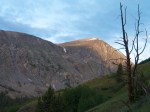
- The first light hits Quandary Peak
-

- Sunrise as we start our assent
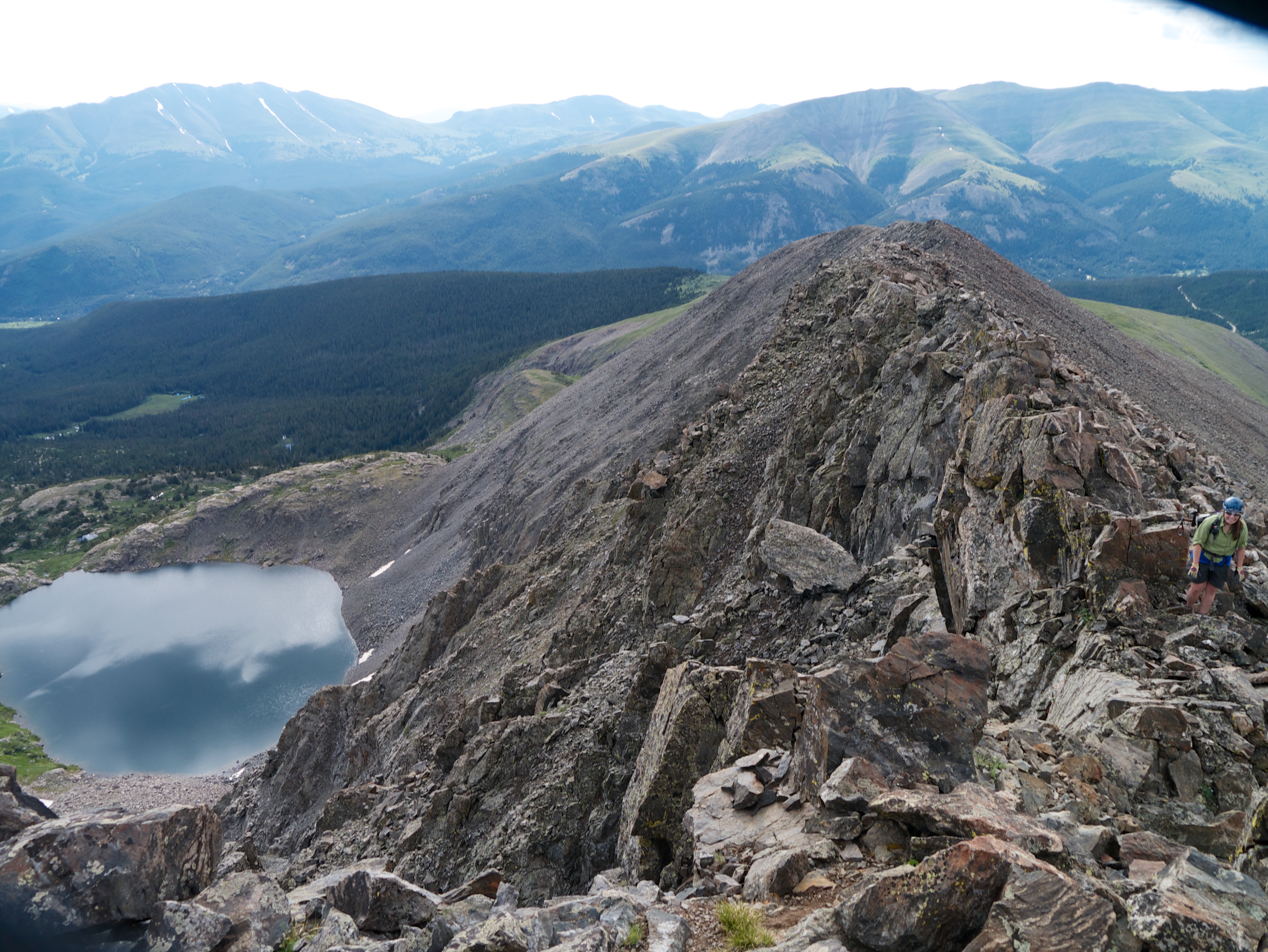
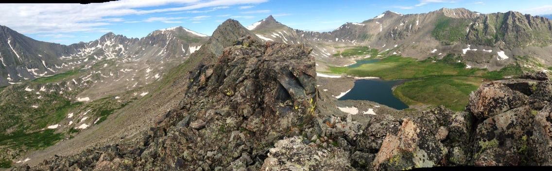
At approximately 11,600 the terrain flattens out into a basin. Here you need to get past some willows, and gain the ridge. Your eventual objective is the high part of the ridge to climbers left. We elected to stay high and to the right to avoid the willows, and then make an angled traverse to the saddle. From here it was an easy walk up the ridgeline. After gaining this ridge the terrain again flattens and you get some great views of Mccullough gulch and spruce creek. Your next objective is to continue gaining elevation on some class 2 talus.
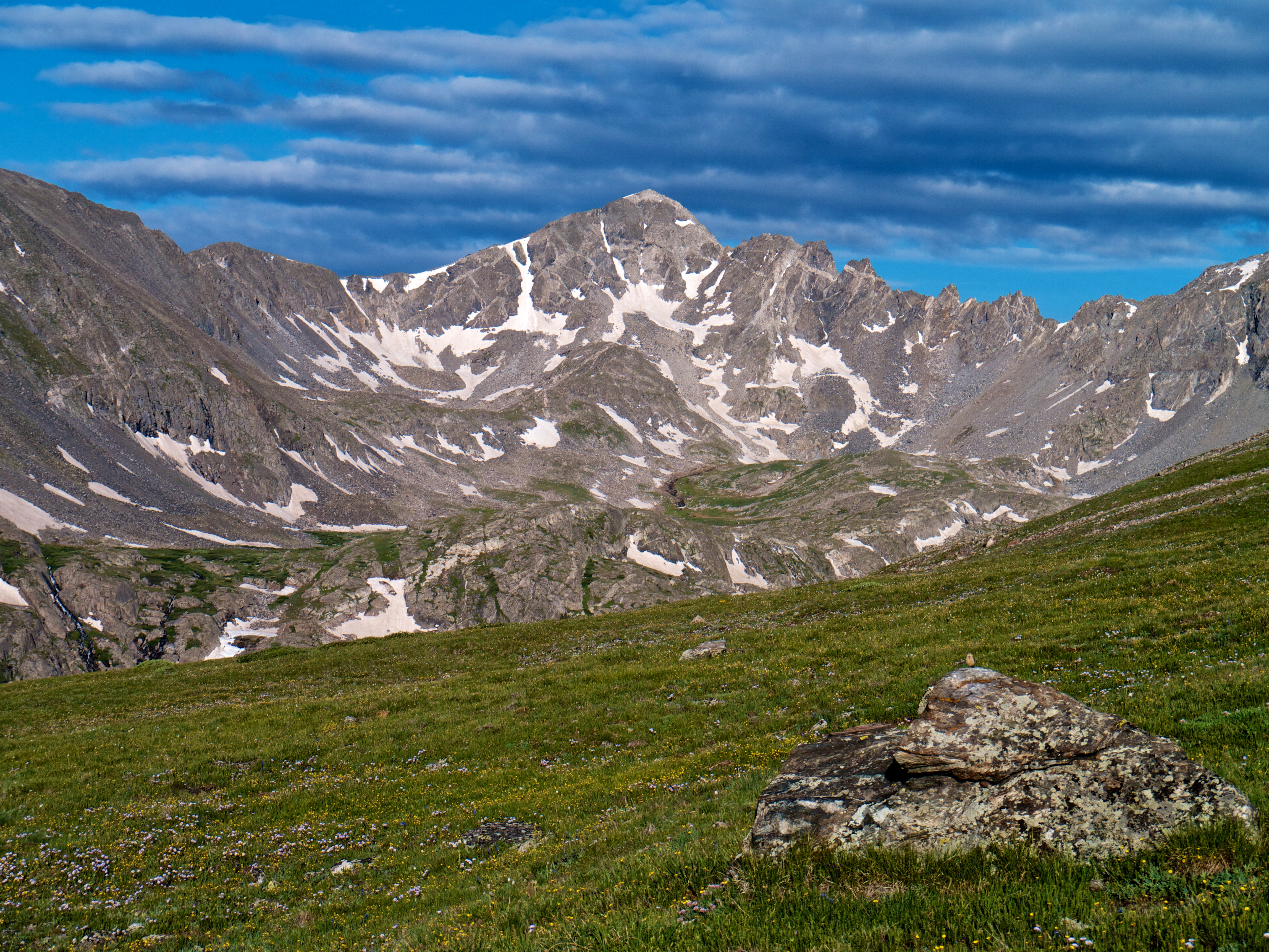
The views of Fletcher Mountain are jaw dropping
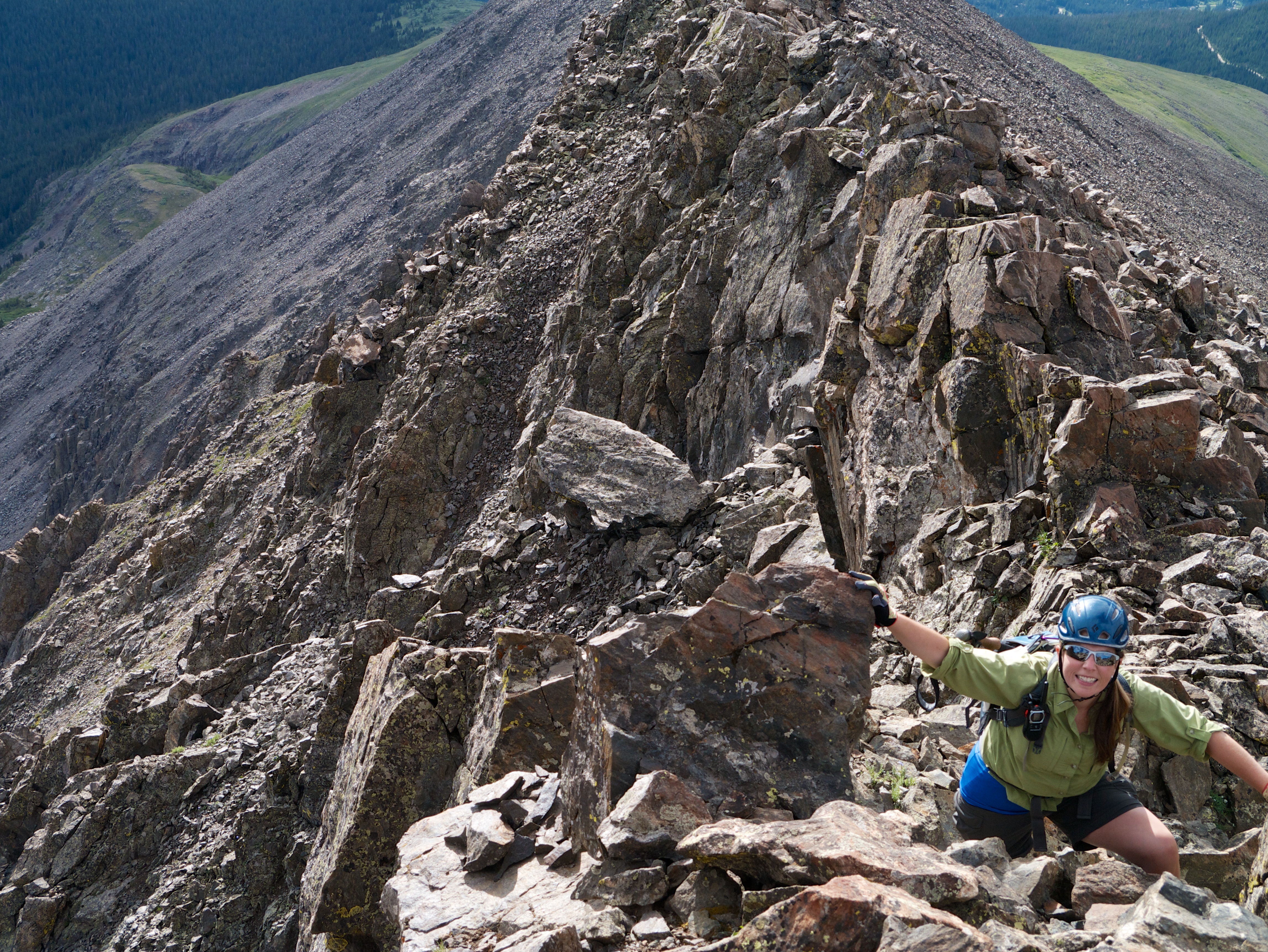
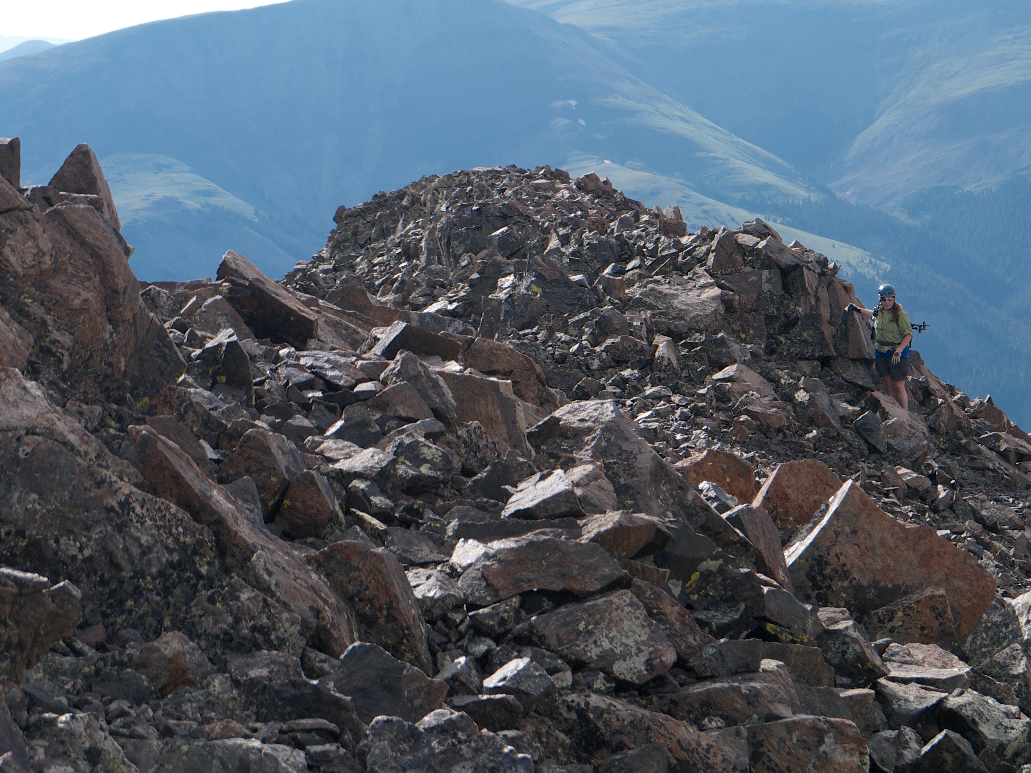
From here the ridge gets more broken and you need to use a little more care. You will have about a mile of scrambling before the terrain becomes easier again.
Topping out on the first tower

Geez my pack is a sloppy mess 😦
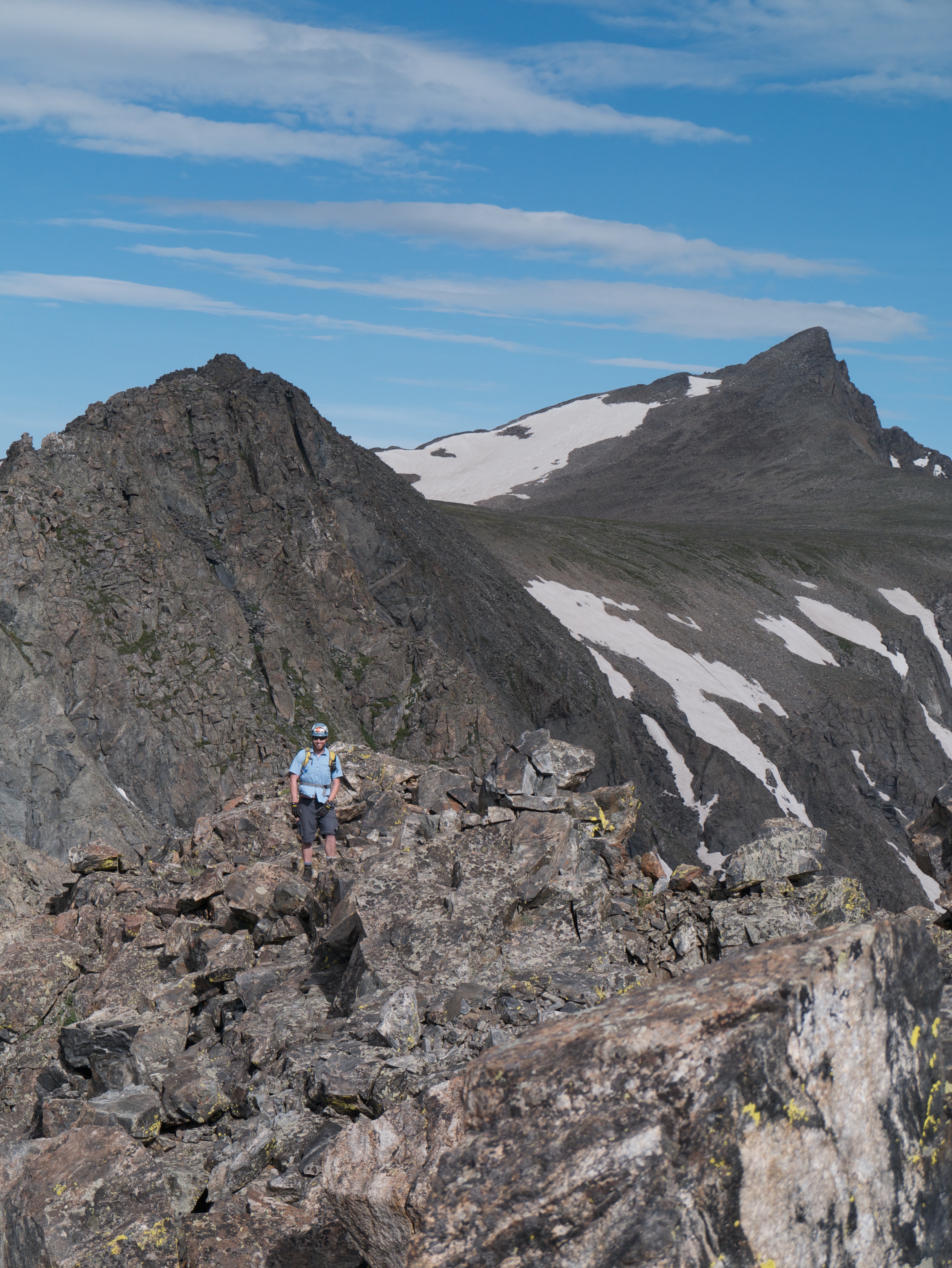
Me enjoying the ridge
Looking back on the ridge
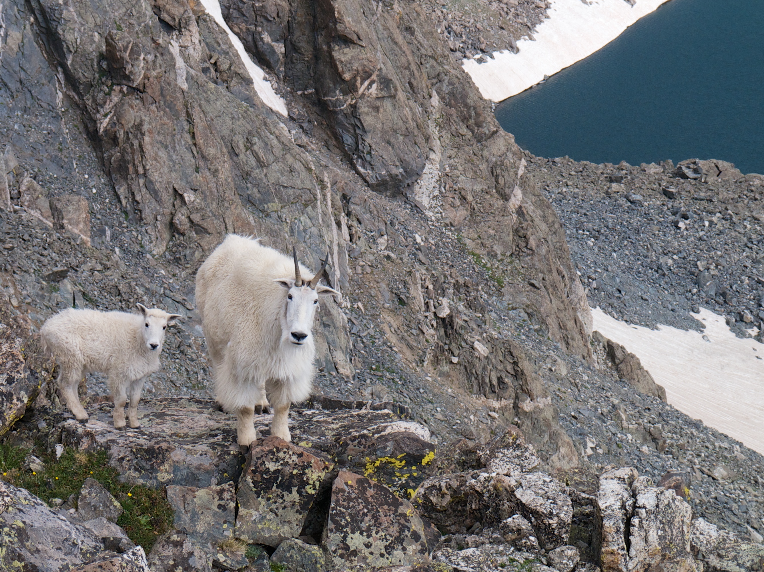
About midway through the ridge I spotted a goat. Angela was a ways behind me, and I had given her the good camera for a while. I dropped down below the goat, and aimed for a spot I thought I could get a shot of him with Fletcher in the background. After snapping a few shots with my cellphone camera the goat circled around in front of me, and became more aggressive. I quickly got my pack off and traded my phone for my ice axe. I yelled at the goat and he backed off.
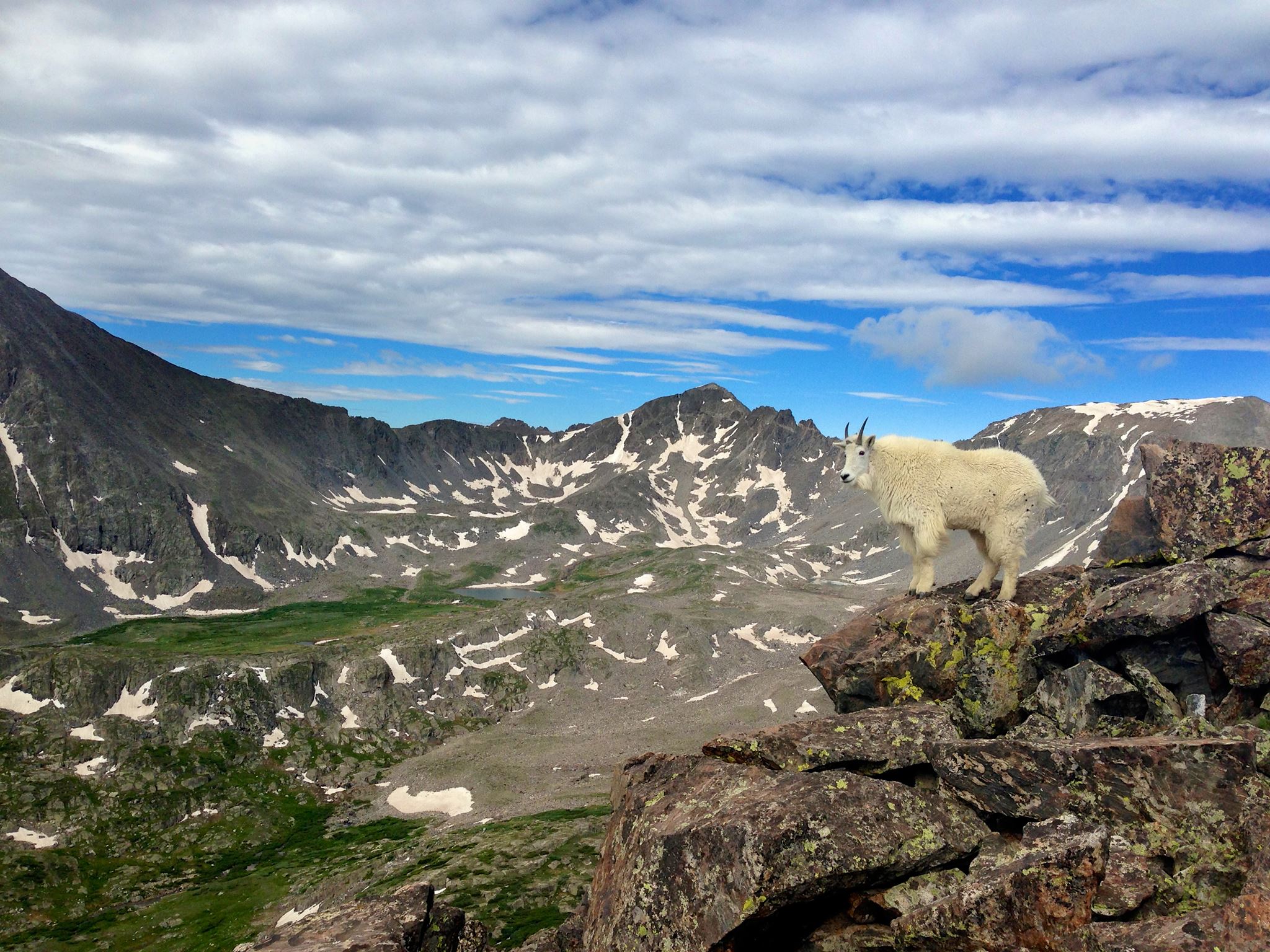
Angela caught up to me and we proceeded on the ridge. The reason for the goats aggressive behavior became apparent when we spotted a baby goat with its mother.

A view of Mcculough Gulch to the left, and Spruce creek to the right.
We ended up bailing out at the end of the ridge without actually summiting this peak. The ridge took longer than anticipated and there were nasty clouds building on the horizon. Mcculough gulch is rough and slow going for a descent. When you hit the lake you will be greeted with throngs of people up to enjoy the lake / waterfall.

Looking up at the ridge from McCulough Gulch
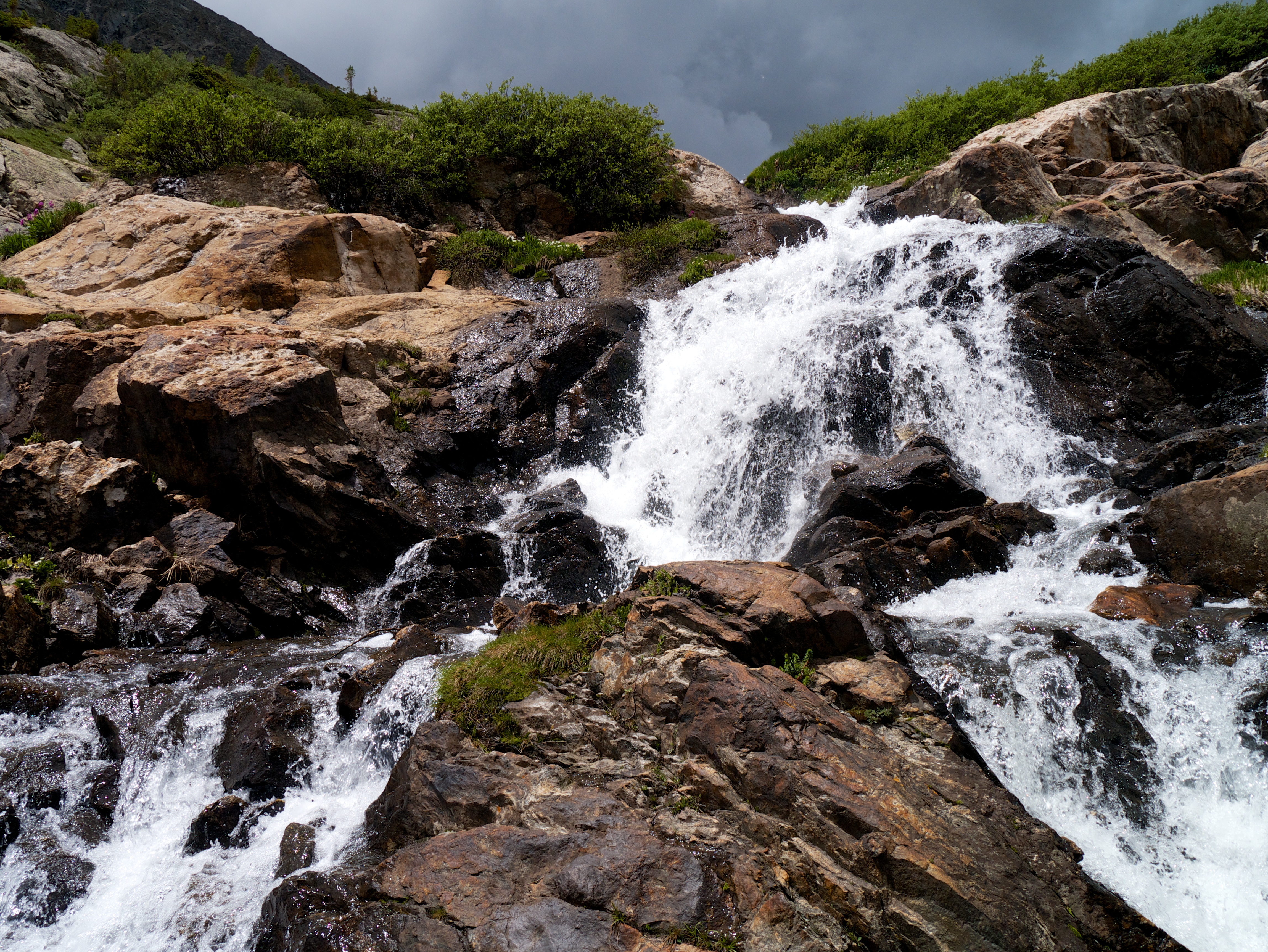
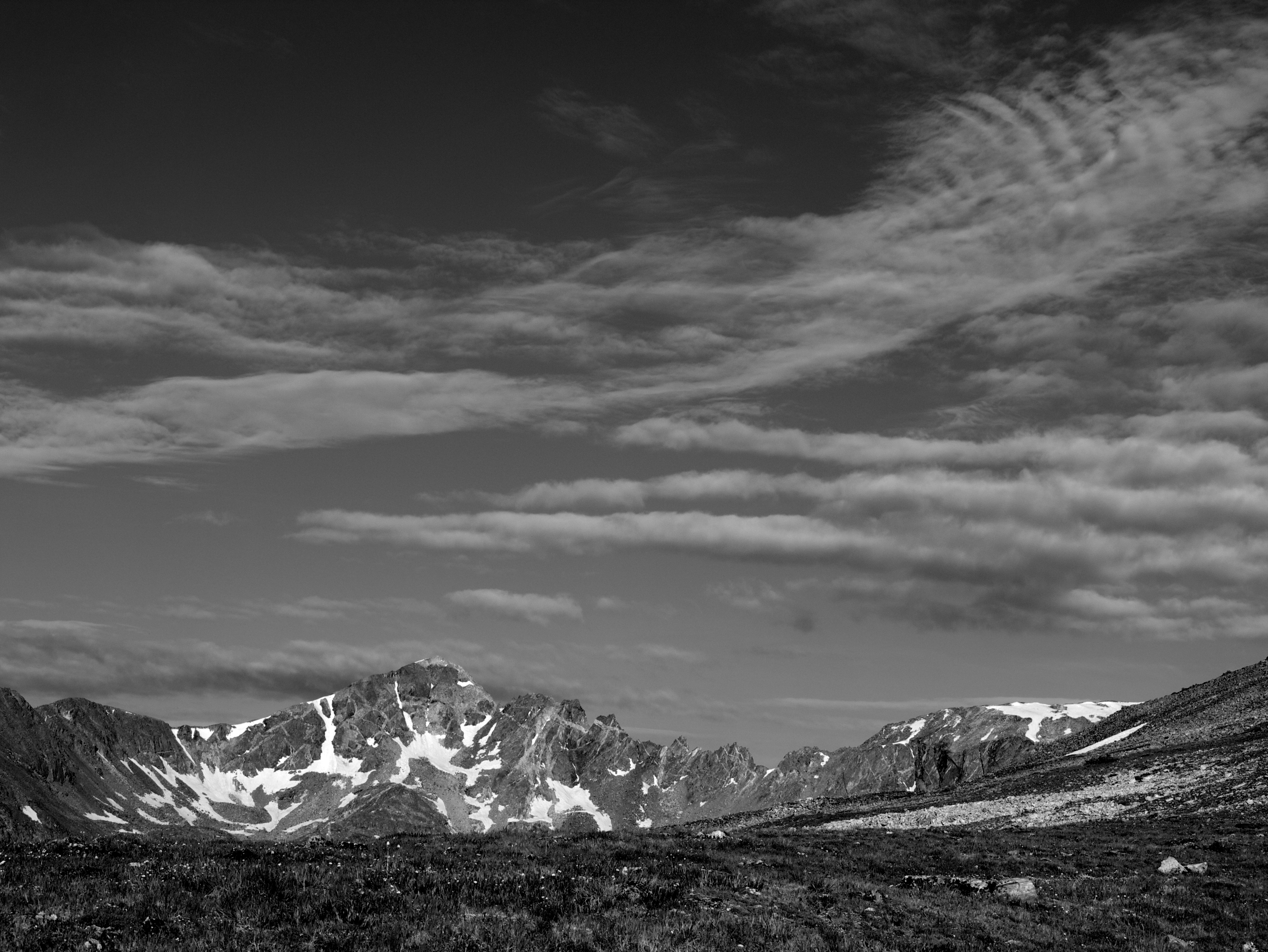
A storm brews over the waterfall

Awesome job guys! Definitely adding this to the to-do list!